goldtruck here are the links to geovic:
Geovic 2:
http://mapshare2.dse.vic.gov.au/MapShare2EXT/imf.jsp?site=geovic
Geovic 3:
http://er-info.dpi.vic.gov.au/sd_weave/anonymous.html
I would suggest you use Geovic 2 to start with as its a bit easier to use. Once you get a feel for how it works move onto Geovic 3.
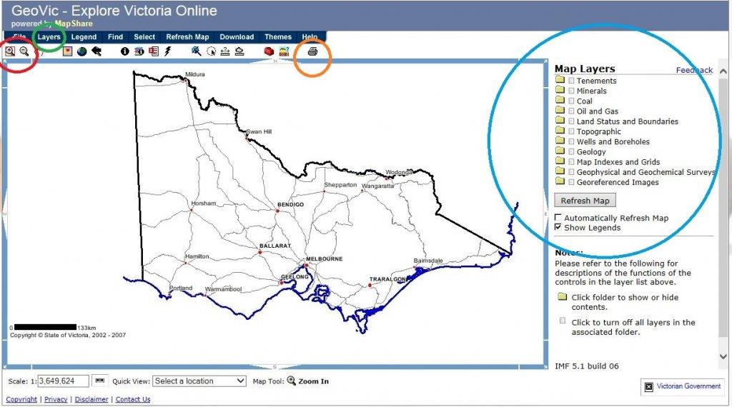
The red circle is your zoom and pan tools, click the zoom in button and then drag a square out on the map around the area you are interested in. The hand symbol will let you pan left/right, up/down. Left click hold and drag.
The green circle is the layers button click this to reveal the layers (shown in the blue circle right of screen)
Under each of these folders are the different layers. The main ones you will probably be after are under the minerals folder, try ticking the box next to Mines and Mineral Occurences then click the grey "Refresh Map" button at the bottom of the folder list. Remember if the tick box is greyed out it is beacause you aren't zoomed in far enough.
Have a play with the different layers to get the info you are after.
Once you have what you want create a PDF by clicking the print icon. (Orange Circle).
This should get you going. Yell out if you get stuck.
https://www.prospectingaustralia.com/forum/img/member-images/3243/1433812881_capture1.jpg


")