- Joined
- Mar 1, 2019
- Messages
- 23
- Reaction score
- 70
Hi everyone,
I'm new to prospecting trying to understand what's going on in a section of creek that I was working near Daylesford.
I found a large section of exposed bed rock on the edge of the creek which ran back up in to the side of the gully, a smaller piece of it is jutted out in to the water and sat above the water line overgrown with black berry.
But I figured it was a likely spot of low pressure when the river was in flood and started working it.
Digging down brought up a bunch of iron stone, small zircons typical of the area and some fine gold, nothing unusual for this creek.
This was all sitting on top of a layer of grey really sticky clay about an inch thick.
Beyond the clay layer I started to find some more iron stone so kept digging it out but no gold, fewer zircon, mostly just iron stone, albeit much smaller than what was sitting on top.
Again I hit another clay layer, this one thicker and this was now beginning to move further in under the bedrock slab and away from the creeks current water flow.
Having not found any gold in this second layer I thought it might not be worth digging much more so just decided to fill up a bucket and process just to see if anything was there.
This next layer was really different to the rest, I've taken photos of the stones I found as I'm not sure what they are, but they were larger and more water worn apart from some pieces of chunky mineralized quartz.
Among it I also started find these clear quartz crystals, some clear bluish flecks of crystal and a quite a nice little gold picker, although there was no fine gold in this layer.
I'm hoping someone could explain what would cause a sudden difference between these clay layers and is it possible that I was starting to dig through an older part of a river system or is it still just deposits from the modern one in place?
The plan is to move further down stream following the slab of rock (it's metres long) and try and identify similar material to what I found in the 3rd layer and hopefully find some more of those crystals and maybe some more bits of gold like the first one.
Thanks in advance.
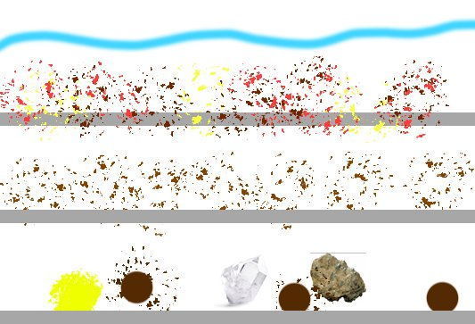
Realistic depiction of the layers. layful:
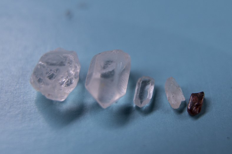
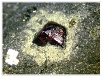
Quartz crystals found in 3rd layer, zircon was in the top layer, find lots of these here
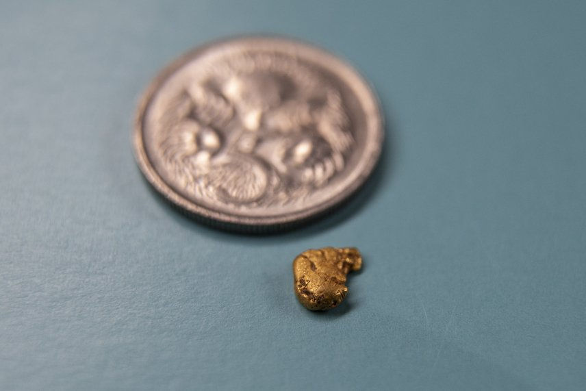
little picker
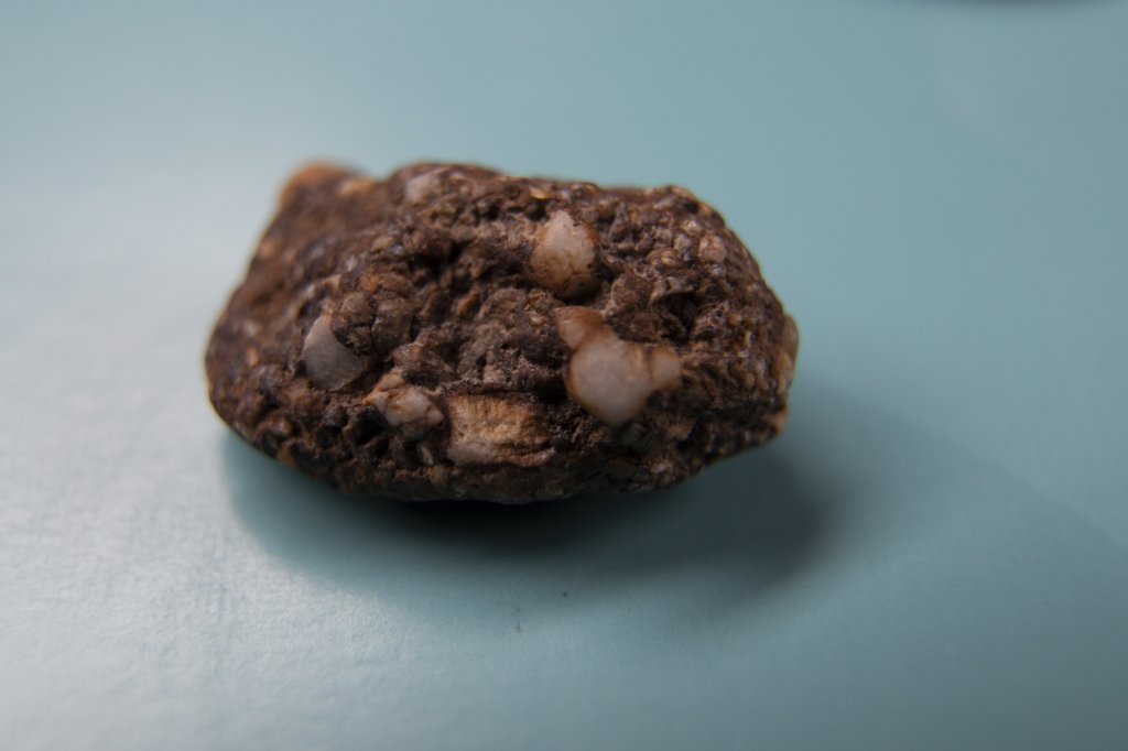
I haven't seen any rocks like this in the creek before - some sort of conglomerate I presume.
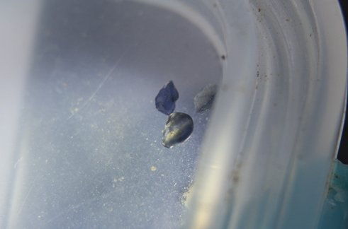
Not sure what these ones are, quite nice and blue
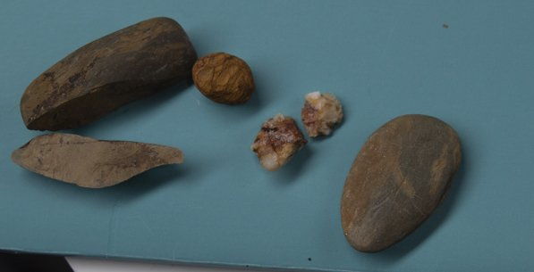
These are the sorts of rock I was finding in the 3rd layer, very different to the stuff before
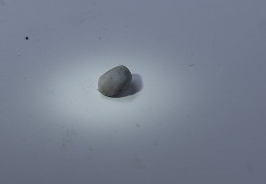
I'm not sure what this one is, has a bluish tinge to it though.
I'm new to prospecting trying to understand what's going on in a section of creek that I was working near Daylesford.
I found a large section of exposed bed rock on the edge of the creek which ran back up in to the side of the gully, a smaller piece of it is jutted out in to the water and sat above the water line overgrown with black berry.
But I figured it was a likely spot of low pressure when the river was in flood and started working it.
Digging down brought up a bunch of iron stone, small zircons typical of the area and some fine gold, nothing unusual for this creek.
This was all sitting on top of a layer of grey really sticky clay about an inch thick.
Beyond the clay layer I started to find some more iron stone so kept digging it out but no gold, fewer zircon, mostly just iron stone, albeit much smaller than what was sitting on top.
Again I hit another clay layer, this one thicker and this was now beginning to move further in under the bedrock slab and away from the creeks current water flow.
Having not found any gold in this second layer I thought it might not be worth digging much more so just decided to fill up a bucket and process just to see if anything was there.
This next layer was really different to the rest, I've taken photos of the stones I found as I'm not sure what they are, but they were larger and more water worn apart from some pieces of chunky mineralized quartz.
Among it I also started find these clear quartz crystals, some clear bluish flecks of crystal and a quite a nice little gold picker, although there was no fine gold in this layer.
I'm hoping someone could explain what would cause a sudden difference between these clay layers and is it possible that I was starting to dig through an older part of a river system or is it still just deposits from the modern one in place?
The plan is to move further down stream following the slab of rock (it's metres long) and try and identify similar material to what I found in the 3rd layer and hopefully find some more of those crystals and maybe some more bits of gold like the first one.
Thanks in advance.
Realistic depiction of the layers.
layful:
Quartz crystals found in 3rd layer, zircon was in the top layer, find lots of these here
little picker
I haven't seen any rocks like this in the creek before - some sort of conglomerate I presume.
Not sure what these ones are, quite nice and blue
These are the sorts of rock I was finding in the 3rd layer, very different to the stuff before
I'm not sure what this one is, has a bluish tinge to it though.