Fossickers / Prospectors - iPad / iPhone / Android App in development

Prospecting Australia

Help Support Prospecting Australia:

This site may earn a commission from merchant affiliate links, including eBay, Amazon, and others.
Hi Max,

I will be releasing an iOS version first that will run on the iPhone and iPad. Following that I will be working on the Android version. By doing it that way 70% of the code required for the Android version will already be in place.

Apologies to all for the delay with this but life tends to have a way of throwing few wobbly's at you and generally getting in the road of doing what you want to do. i.e. my Clutch died in the Troopy and had to be replaced completely, parts flown up from Brisbane, including all associated systems master / slave cylinders, etc. a week and $2000 later it was back on the road. It was a good thing I was also laid low and off work with the flu at the time so I didn't need to use it, hey 8)

I am however now back on the case and making good progress.

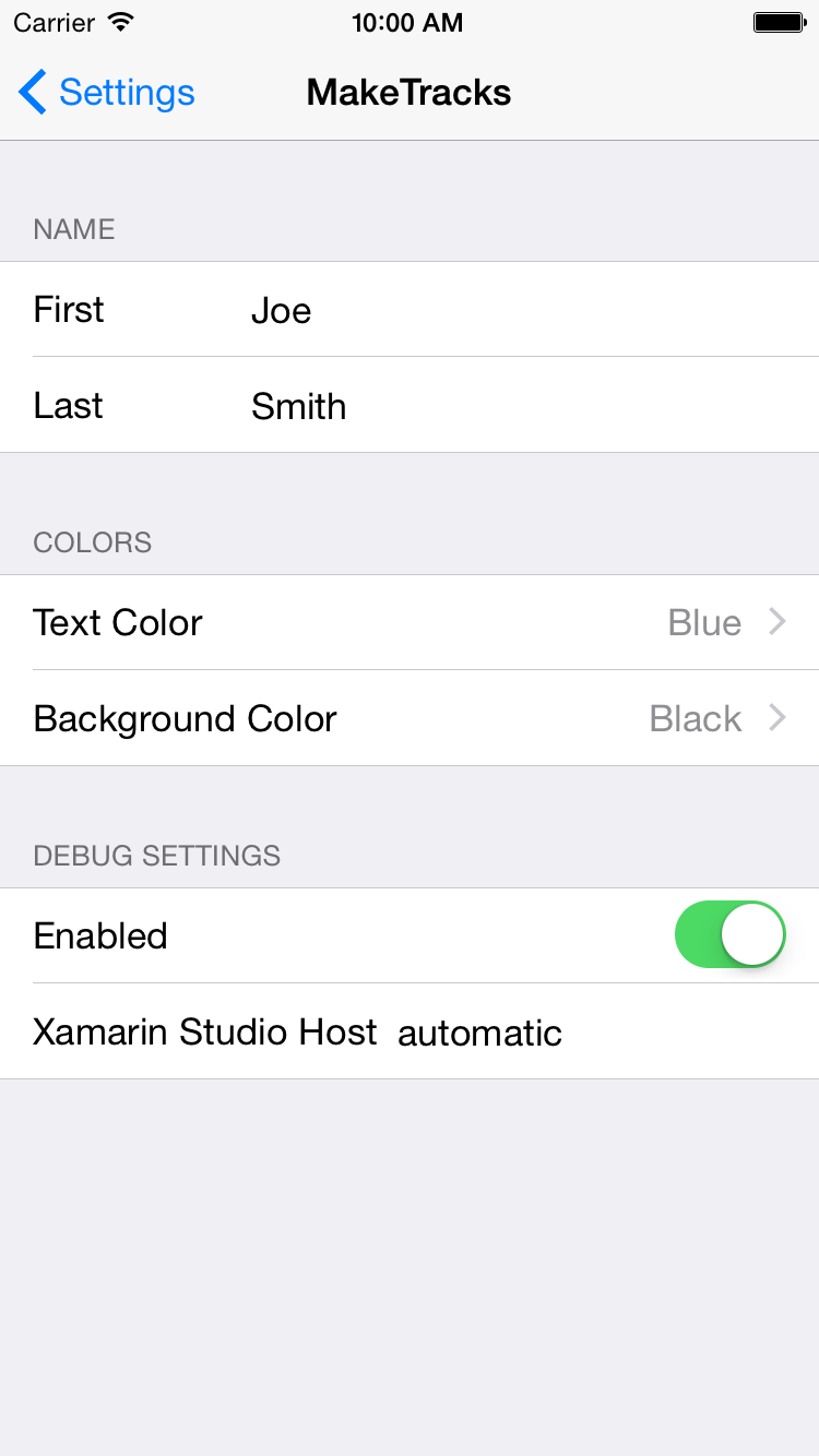
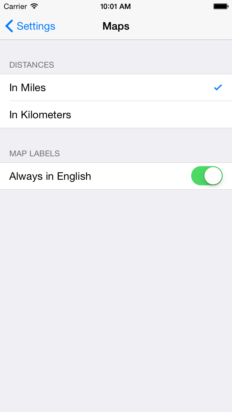
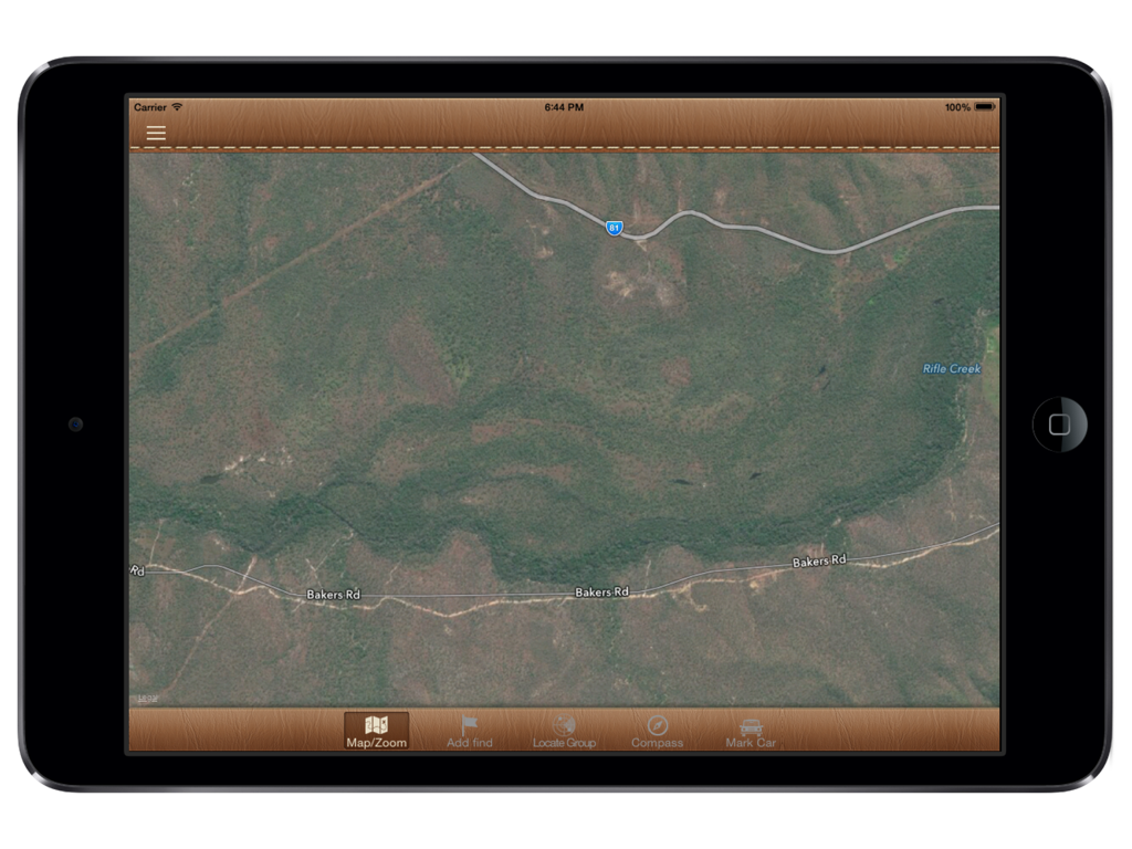
I showed the app to a couple of the fellows at the Cairns Coffee catch-up on Saturday. I have it running on my iPhone and iPad already. Its early days yet so it doesn't do too much just yet. But I have it displaying the map and tracking the users heading, speed, altitude, position, etc. Thats why its an Alpha version. :p

I am currently setting up a way people can download an Alpha version of the product shortly to test it out on their devices and provide feedback.

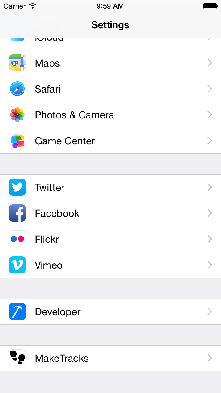
To do this I use a third party website as do most other App developers. This will require you to setup an account with the third party and register your devices with them. That way I can then provision the software on the devices. Its a bit involved and all to do with Apples distribution model / license but its the only way I have of providing test versions of the software to people. I will send an invite out shortly.

Cheers,

Grant

PS.
I would hate to think where to start with something you are trying to achieve.

So would I :D
 
No good about your clutch mate hope the project is coming along nicely. Had a thought and it may already be in the design but ive found by logging the altitude in areas im working ive been able to work alluvial more effectively. I wonder if you coukd search for logged gold finds at altitude within a certain range?

Just a thought even if you could export to csv this wouod achieve the same result.
 
Hi Golddig,

Yeah clutch was completely roasted they even found the fins at the back had broken off and it had worn down to the rivets on the clutch plate there was bits of metal in the transmission oil, a complete mess. Guy who had it before me advised he had upgraded the clutch to a heavy duty "Truck' clutch and I had to double shift. Should have picked up on it then. He was towing a large caravan around Australia so it figures.

Great idea on searching altitude however it wont be for a while as in Post 31 I advised:

Please speak up now as I will be closing the scope of the product off at that for the 1st Release at the end of this week? There will be other releases so its not your last chance to have a say in its development if you miss out this round.

So it will go into the 2nd Product Release list of features. I need to build the base finds database before we can actually search it. :p

Cheers,

Grant
 
hmmm I am always reluctant to trust anyone selling a car :) especially 4wds' Ive purchased some problems in my time i tell ya.

Clutches are a tricky one but i usually find if it doesn't feel right it aint right, i'll have to wait for the android release anyway mate :) be buggered if i ever go back to apple, they can have their fruit salad.
 
Hi Grant, i am sure we are all waiting to see the versions you are working on. I am very interested to give it a go if you like, but will wait like the rest of us.
I have an iphone 4 is that ok to use with your IOS version.
I think you are doing the prospecting community one hell of a service by doing this. It will make our lives so much safer and easier.
Cheers Jack ;)
 
Hi Grant, thanks for all of the information. Over the last 2 years most of my family have gone to iPhone, so it looks as though I must also give iphone a go. I have an iPad which I find very useful. I am looking forward to your program, as I believe it will be a very useful tool out in the bush. I usually a good sense of directions, but one thing I have learnt is when you are wondering around with a detector, your head gets turned very quickly. :eek:
Before I go out detecting I study maps, but a hand held device with gold maps etc will be invaluable.
All the best and look forward to detecting with your program.
Cheers
Max
 
Hi All,

Well I have been doing more work on the app. Apologies for the slow speed of development but I only have week nights and weekends to work on it.

I had to get over an issue that was causing the app to crash at startup without giving me any details at all, most frustrating. Took me most of a weekend to work out that it was a PICNIC error (Problem In Chair, Not In Computer). :8

So I have now implemented a global exception handler so I can catch any crash as it happens and can get the full details on the issue. Once I had that in place it took me only 5 minutes to fix the issue. :D

The third party site I am using will allow me to see these crash details should you choose to report them to me so I can work out how to fix any issues for you quickly. You will also be able to provide feedback on the app at the same site you download the app from.

I will be calling for a hapless victim....err I mean kind volunteer to test out the third party site for me shortly. :D

So I am currently working on the settings screen. i.e. how you configure the app to do your bidding :p

1411862588_ios_simulator_screen_shot_28_sep_2014_9.59.56_am.png


I thought having your name and nickname might be good as it might be good to have a Group option where when you are out with a group of people you could see them on the map like a Radar screen so you don't lose anyone in your group out in the bush. It might help get you back to the group also. It happened to our group on one trip, one of the fellows was lost but still just within UHF range and we had to drive around and use the car horns to guide him out of the bush back onto the dirt track.

1411862621_ios_simulator_screen_shot_28_sep_2014_10.00.05_am.png


Ignore the Debug Settings you see there they wont appear in the released app.

What does everyone else think about having your name and nickname as a setting? I could just make it nickname if people are worried about having their name there.

As anyone in the world could potentially download the app I will probably add the following settings as per the standard Maps app on the iPhone:

1411862694_ios_simulator_screen_shot_28_sep_2014_10.01.14_am.png


So what settings would you like to see in the app?

Cheers,

Grant
 
Brilliant idea!
I didn't read through all the suggestions just yet (too excited! haha) but here are a few I don't think anyone else has mentioned or that just come to mind for me.

-Ability to share locations with other users of the app
-ability to mark certain creeks and rivers (gold bearing, no gold, trace amounts etc)
-Maybe a gold counter. How many hours work for how much gold.
-GPS, turn it on, walk around, it shows you where you've been (pretty sure this has been mentioned?)
-An alarm/warning to sound when you have X amount of time before you will be out of light, and it will take you that amount of time to get back to the car.

I'm sure I'll think of some others later.

The UI is looking great thus far Gcause
 
Hi AusFX, have added these to the Release 2 requirements.

Still working on the 1st Release.

Heres a quick recap of the requirements thus far:

Release 1 Requirements:
maps that show national park boundaries relative to your GPS location
GPS enabled maps so you can navigate to or around crown land features and the boundaries of existing EL's and ML's
GPS enabled mapping on mineralogical and radiometric maps
EL and ML data optional to turn on and off that tells you the expiry , holders name and mineral types
Lists of fossicking areas across Australia
A note pad style thing for putting info about your finds/where,pics,be able to pin the location on a map
Instant messenger
audio output mapping with gps coordinates, [1] so I don't walk over the same area twice [2] audio frequency mapping matrix to objects [3] review and be able to analyse data from the trip[4] sharing data optional with other prospectors to avoid trashed, overprospected areas.
[5] GPS messenger , for emergency
[6] alerts on old mines and shafts
store the info locally on the device and then you could sync the data back to your PC at home to load it into your favourite mapping tool like Google Earth.
layers mostly in vic geovic data I.e.e leads working detail etc. O e app I use allows me to import old maps and syc them with locatipns to give estimates of location.
Adding waypoints with the ability to take a photo and link to the waypoint and snyc with cloud feature so o can show people where ive been and look at tgis on my pc as well.
a GPS emergency locating signal would be handy [with a auto dialling signal]
a feature could be to detail what type of gold was found in each location eg: alluvial, reef, fine coarse or shotty etc. It might be a stretch but then people may be able to figure out if an area is worth doing their type of prospecting in, detecting or panning?
Could you include UTM as well as Lat/Long, it's much easier to work in meters when transferring waypoints to and from paper maps and GPS, rather than juggling degrees minutes and seconds?
an options setting so people can choose coordinate system i.e. UTM or Lat/Long, they want to use by default.
a gps that does a decent job of logging.. finds, where you left the car, and how you get back.
a gps that has topographic maps with hiking and fire trails updated, a normal road map, geological maps and a mineral resources maps would be good.
a nugget finder (wishful thinking) :)

Release 2 Requirements:
logging the altitude in areas im working ive been able to work alluvial more effectively. I wonder if you coukd search for logged gold finds at altitude within a certain range?
Ability to share locations with other users of the app
ability to mark certain creeks and rivers (gold bearing, no gold, trace amounts etc)
Maybe a gold counter. How many hours work for how much gold.
GPS, turn it on, walk around, it shows you where you've been (pretty sure this has been mentioned?)
An alarm/warning to sound when you have X amount of time before you will be out of light, and it will take you that amount of time to get back to the car.

Cheers,

Grant
 
Good luck Grant, can,t wait to see the finished app. I am a beginner and will be going on my second fossicking adventure this weekend, I could sure use you app now to make sure I dont get lost LOL
Cheers Debra
 
Hi Grant and all interested forum members, There was a new Victorian government mining information service released this week, "Mining Licenses Near Me". I have had a look and it is certainly interesting. Works on PC, Ipad and Iphone5. This appears to have some of the features Grant was talking about and he maybe able to use this in working on his app.
Link below:

http://www.energyandresources.vic.g...maps-reports-and-data/mining-licences-near-me

One thing to keep in mind, when I entered the program I was asked if you wanted to "share your location" with Vic Gov site, so that one will be up to you guys to sort out for yourselves.
Cheers
 

Latest posts

Top