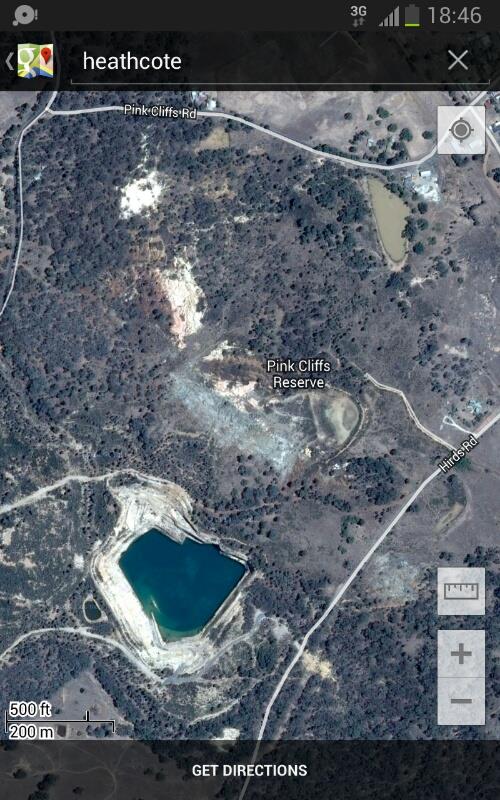
As we know when looking down from satellite view, we get to view the quarries and what they are digging at, depths, drill holes for explosives etc. Like the Road Cuttings gallery thread, I thought I'd start this for others to share quarries thet find interesting, geology wise. They can sometimes be a direct window into the strata of our earth, so if you'd like to join in, feel free. I'm still learning geology, and every bit helps. What do you see in the photos etc..I'm not sure how this will go..but may become another interesting topic. Locations of quarries can be listed if the uploader wishes so we can zoom in and out in sat view?
Mods - i cant decide where to place these threads having no geology sections or similar at the moment..place them where you will
Below are some examples:
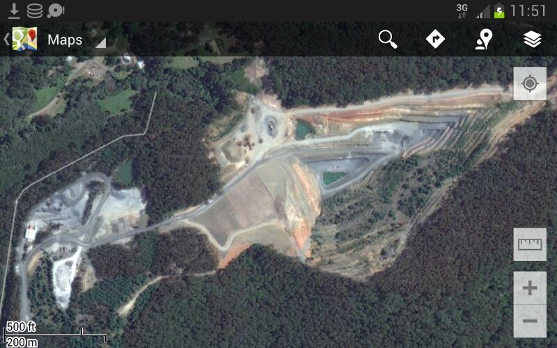
This is a general quarry for road surfaces and concrete aggrigates mostly. By the looks of it, they are getting into those mudstones and silts towards the bottom. Is this correct?
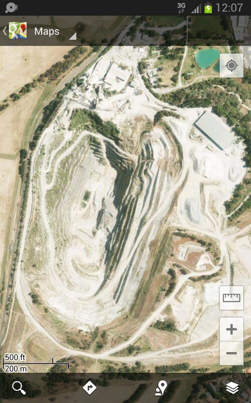
Here's the local Lilydale, VIC, limestone quarry and has been a supplier for australia for many years. Lime and marble being the most used. I know this quarry contains pockets with calcite crystals and fossils of small crustatians. It the very near future, it will close, be filled with water, and turned into an estate unfortunately. I'm trying to get contact to preserve a few trailor loads.
Mods - i cant decide where to place these threads having no geology sections or similar at the moment..place them where you will
Below are some examples:
This is a general quarry for road surfaces and concrete aggrigates mostly. By the looks of it, they are getting into those mudstones and silts towards the bottom. Is this correct?
Here's the local Lilydale, VIC, limestone quarry and has been a supplier for australia for many years. Lime and marble being the most used. I know this quarry contains pockets with calcite crystals and fossils of small crustatians. It the very near future, it will close, be filled with water, and turned into an estate unfortunately. I'm trying to get contact to preserve a few trailor loads.