OziExplorer GPS Mapping Software

Prospecting Australia

Help Support Prospecting Australia:

This site may earn a commission from merchant affiliate links, including eBay, Amazon, and others.
Joined
Feb 15, 2015
Messages
244
Reaction score
282
Ok, Mapping, a top resource for maps showing mine and prospect locations, can be imported into Ozi with georeferencing but with care. Go to below website add layers that you require to map of interest, zoom in or out to get area and download then import into Ozi, of course this is for QLD but imagine other states would have such sites. Be careful with download and import and check to ensure georeferencing is correct.
minesonlinemaps.business.qld.gov.au/

I think that is enough info for now as navigating around layers and getting the results, can be a lot of trial and error. But well worth the time, once you have it right.
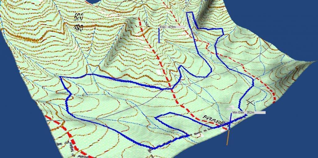
For Oziexplorer PC, 3D, PocketPC, Android, mapmerge and a lot of other info to get you going just google Oziexplorer website Au. and visit, shareware versions available for trial, but they have limitations.
I have no interest in Oziexplorer just am a long time happy user.
Imagine other Ozi users in forum have plenty of info on mapping, and devices they use it on.

Unfortunately I cannot post links until I have 10 posts thus have given a general address.
 
i have been using Ozi since it's inception , have every digital map i can lay my hands on covering all of Australia , state view and ubd street maps, from another life as a one time lead first to find geocacher
it is pretty good for plotting

i have it on pc, pocket pc , windows phone and last but not least on an eee transformer pad
 
Hey doc email me a map of tazzy! Lol :p
Just jokes but i would love one of land surrounding gympie if it can be done im not computer savy ...be your friend forever...plz
 
I started using Ozi when with the DOD, I have a good collection of maps and use it on Laptop at home and in the caravan. Also have the Android version on tablet and on smart phone, I'll add some links to devices and produce some screenshots as we go. Also what is needed in various devices to get it working as it should.

As my Ozi software is licensed, I have full functionality, so some of what I post may be reference only to those with trial versions. Note, the App is not expensive and as software goes the PC version is a reasonable price. What can cost are the maps.

Here's a list of the software I use;

OZIEXPLORER (both PC Windows and Android versions) - This is the base program to view and calibrate maps, plot waypoints, tracks and other info on the map, will communicate with a good range of handheld GPS units so data can be downloaded to GPS or uploaded from GPS. Requires a digital map image in a number of formats along with a .MAP file which in simple terms is the calibration file that contains the stored latitude/longitude and grid reference data.

OZIEXPLORER3D - Opens automatically when an area is selected in Oziexplorer to generate a 3D image. This program requires topographical height data installed on the PC and the path entered into the Oziexplorer file path configuration. The output is saved as a 3D file and can be also saved as a bitmap image.

MAPMERGE - This application allows the user to put a number of single map sheet files, usually adjacent, into a folder and then "stitches them together into one map image and 1 .MAP file.

IMG2OZF - This is an image file translator that converts .JPG and .PNG, plus other formats into native Ozi file format.

GPS PORT CHECKER - When a GPS is connected to a laptop, Oziexplorer requires the PC Port number to be entered into its config file. This can be a bloody pain to ascertain. So, plug the GPS into a USB port, switch it on and run the App. It will then check all PC ports and eventually list all, noting which number port your GPS is connected to.

More to follow.....

FYI - For further basic info, do as suggested above and visit oziexplorer.com and read (these are Australian designed applications, which are exported overseas)

The email address is [email protected] the guy on the other end is Des Newman. I've found Des to be helpful with any questions I've had.

I have no affiliation with Des or Oziexplorer, other than being a satisfied customer.
 
i agree oziexplorer is my default... have plenty of really expensive gps software and mapping software but i once imported 100+ topos into ozi and wherever i am i open it up clikc open map open any map at all and it open the one relevant to where i am. so i can track gullies or creeks and old working detail. wish i could work out how to layer deep leads over the maps i have...
 
Geological Maps in digital format are available from QLD mines( not georeferenced for Ozi) for downloading, imagine Vic ones are available from Vic mines. The QLD ones go down to 100,000/1. The Vic ones should display the deep leads as well as strata, faults etc., but as deep leads are not relevant up here in NQ, suggest you do a bit of wandering around Vic mines site. I know has taken a lot of hours to navigate Qld mines, to get what I have and I think have only just scratched the surface. Lot of data.
 
here's a jpg screenshot of an Ozi3D image I created. You can see that it shows the topography in a 3D format, which in the 3D app, you can zoom, or spin around. This allows me to see where the hills and gully and re entrant detail are before I ever go there and to plot a track showing where the old gold workings are relevant to them are.

1424396977_ozi3d.jpg
 
Hi All
I need some advice on Oziexplorer, this is what I want to do.
I would like to use Ozi as a moving maps navigator device on a quad with a GPS receiver, I will need to be able to ad waypoints to Ozi from my hand held Garmin 76s GPS & vice versa, I would also like to be able to utilise Google Earth images as overlays on Ozi as well as Geological maps.
I intend to use a Samsung android device, what I need to know is what specs should I be looking at for the Tablet or Samsung note to ensure that it all runs as it should??
What make/ model GPS receiver would be best??
Do I need to use base maps? or something similar?
Is there a way to load tracks & waypoints from the Garmin to Google Earth???? if so do I need a specific program???
I have been using GPS devices for 10+ year. But have never tried to load the info to a PC or from PC to GPS, so I need a bit of advice on how to best achieve this.

If any- one is a Guru on this stuff I would really appreciate some advice/ help

cheers
Lee
 
Gday mate, I think I can help with one if your questions. I use a garmin GPS for moty riding and now prospecting. I have downloaded a series of maps online including topo maps and just add them to the garmin via a memory card with a folder called garmin with the image files of the maps within. Just a way of getting around spending hundreds on maps as the base map didnt even have my street in suburbia listed or tracks in the bush for that matter.
I have saved tracks in the garmin a while ago, from memory they save as .kml files which you can overlay on Google earth. From what I understand there I'd also a range of free software you can use for editing routes and adding waypoints etc. I was also able to create tracks on Google earth and save them as a .kml file so the garmin would recognize them and I could upload them on the garmin for reference. It was a bit fiddly but does work. Hope this is of some help.
 
I have a galaxy note tablet and a galaxy s3 phone which is what I use when out in the bush, both run ozie fine so you should be right as far as Samsung stuff goes, not sure about other android devices though.

I think the main thing to look for is that whatever device you want to use, that it doesn't have ONLY assisted GPS (A-GPS) which uses cellular data. Older iPhones for example had only this and not a standalone GPS and were therefore useless with no phone signal (and pretty useless with).
 
I use Ozi Android on a Samsung Galaxy S4 (previous a S3) also on a Starpad 7" Tablet. I also have the full PC version on my Laptop.

Regardless of device, you will need to have some kind of Topo Map on either PC or Android. The base map on any GPS is pretty crappy. I have Garmin Topo on my E20.

I download waypoints from my Garmin E20 to my laptop Ozi as well as the logs from the Tablet, easy to do. I can then modify and or save the Waypoint or track logs to a file and then copy those files to my Android device.

The biggest difference between Android Ozi and PC Ozi, is that you can pre construct Waypoints, tracks and other info on the PC version, you can't on the Android version.

However Tracks and Waypoints saved to a file or a log can be copied both ways and used on both devices. I have not tried to connect my E20 Garmin to the Android version, you would need to ask Des at Ozi for that answer, but my gut tells me no.

Re Google map, I don't bother. The 250k, 100k, 50k and 25k topo maps I have are more than adequate.
 
having run Ozi since it's inception way back then , it is a fine product, i have never found a way to export from andriod direct, all ways use a base pc to do my transfers, there may be a way, i listening if anyone knows
maps on stand alone gps are not useable on ozi, an garmin use gpx files these days to transfer data, babel is a fine program for stand alone file conversion , ie from wpt to gpx or even kml to view in google earth , Ozi Pc has the ability to view google earth as a map , read this page ... http://www.oziexplorer3.com/eng/gm.html
ozi has exports all of the following , gpx, wpt and kml, just have a play you cannot stuff too much ;)

i also have every digital Ozi map know to me , great aid in the bush :cool:

an my recommendation for gps is garmin 64st pre loaded with garmin topo, it even has known mines as poi's , truly a cool bit of kit

https://www.ja-gps.com.au/Garmin/gpsmap-64st/

an this is what i run Ozi incar on

http://www.hemamaps.com.au/en/HN6/Hema-Navigator-HN6 :cool:

11258036_10204707199307566_3902425034875479361_n.jpg
 
Hey Doctor
Thanks for that info, yeah I planned to use my laptop at home to do the planning & stuff then load onto the android.
If you have any further info please keep it coming, I will ask you some questions when I get up and running with Ozi for sure.

Hi All
So okay I am a little better off today, a guy at work does a bit of what I want to do.
I downloaded "Garmin Basecamp" & can now view my tracks & waypoints & edit such on my laptop, he is going to give me a copy of Topo maps so that is the next step.

I think the big hurdle will be Oziexplorer, so any-one with any suggestions on a particular "Samsung device" to run Ozi would be good I don't know what gig size I should go for & have not really had a look yet, any suggestions on GPS receiver if required would be good to, thanks.

cheers
Lee
 
I think you will find that any current Samsung Android device will work

This is copy/paste from the Ozi Android site


Devices Supported

OziExplorer Android will run on smartphones and tablets which run the Android O/S.
Android 2.0/2.1/2.2/2.3/3/4+ supported.
Portrait and Landscape is supported.
All screen resolutions are supported.
arm and x86 cpu's supported

Note - No useable maps are provided with OziExplorer for Android, only example maps.


We have tested the software on the following devices.
HTC Hero - Android 2.1 (288MB ram) (320 x 480 screen)
Superpad 2 / Flytouch 3 - Android 2.2 (512MB ram) (1024 x 600 screen)
ZTE V9 - Android 2.2 (512MB ram) (800 x 480 screen)


Samsung Galaxy S - Android 2.2 (304 MB ram) (480 x 800 screen)

+ many others
 
gday , you do not need base camp as Ozi will do all that you want, except put maps to your gps ! no biggy

1432413526_ozi.jpg
 
Can anyone give me a clue into how good Oziexplorer is please.
I want to load in into my windows 10 laptop and go bush prospecting ect.
Not sure if you can get Geo maps for it which show fault lines ,I was looking at a HEMA gps for the same reason. It is principally the reason why I want either.
ozi seems good for the price and using a laptop which has a larger screen would be great.
Can anyone with experience help me with a clue here.Can you get and load geo maps for OziExplorer
cheers for any help..

Bush Lover
 

Latest posts

Top