- Joined
- Jul 28, 2020
- Messages
- 85
- Reaction score
- 120
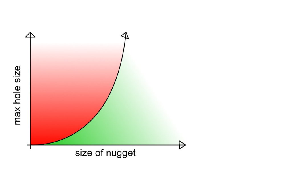
It's one thing to read up on the historical production of goldfields and see how much gold they produced overall, but it's trickier to determine if the gold produced was of a detectable size (and depth).
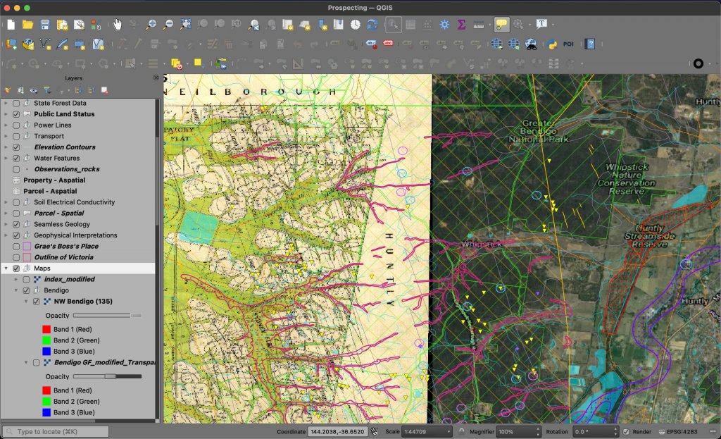
GeoVic (and the data sources it employs) have a lot of information about mines and deposits - reef or placer, production, dates, etc - but it doesn't tell me if there is any use in swinging a detector in the area.
Are there any resources for this kind of information? Maybe gold mining (history) books? I'm willing and able to connect the dots if there are only, let's say, indirect bits of information...
And while I'm at it, what is the definition of a goldfield? In GeoVic and Geological Survey datasets we can see the areas outlined, but what does this really mean?
I'm looking at the geophysical interpretations datasets, fault lines, production centres, elevation contours, watercourses and other things but there is no clear relationship that could lead me to infer the exact extent of a goldfield. Also, many successful mines and workings are not within the bounds of a "goldfield" as such.
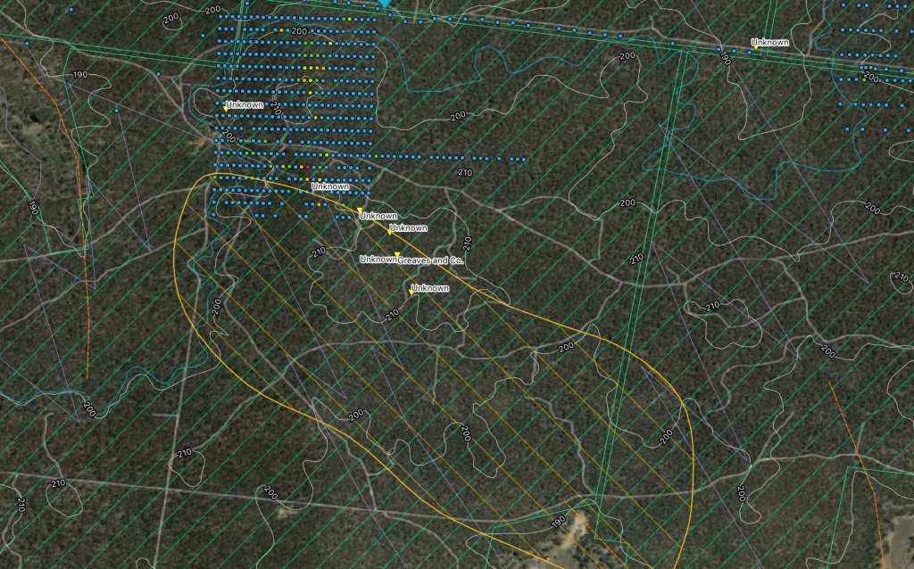
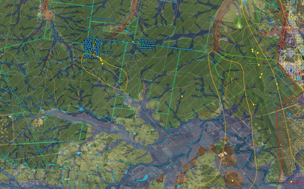
For example, Yankee Creek is a small, minor goldfield east of Bendigo. There are a few mines running NW/SE at the north end of the goldfield and just beyond it, roughly parallel to a faultline. Somebody was interested in the area just north of the goldfield as evidenced by a swath of chemical surveys (probably done by Fosterville) just north of the goldfield. Appreciable gold (more than normal background level) was found in a few of those samples, on and over a hill outside of the goldfield area itself.
So what exactly is a "goldfield"? Clearly, gold is found outside of "goldfields". What defines a goldfield's boundaries?
GeoVic (and the data sources it employs) have a lot of information about mines and deposits - reef or placer, production, dates, etc - but it doesn't tell me if there is any use in swinging a detector in the area.
Are there any resources for this kind of information? Maybe gold mining (history) books? I'm willing and able to connect the dots if there are only, let's say, indirect bits of information...
And while I'm at it, what is the definition of a goldfield? In GeoVic and Geological Survey datasets we can see the areas outlined, but what does this really mean?
I'm looking at the geophysical interpretations datasets, fault lines, production centres, elevation contours, watercourses and other things but there is no clear relationship that could lead me to infer the exact extent of a goldfield. Also, many successful mines and workings are not within the bounds of a "goldfield" as such.
For example, Yankee Creek is a small, minor goldfield east of Bendigo. There are a few mines running NW/SE at the north end of the goldfield and just beyond it, roughly parallel to a faultline. Somebody was interested in the area just north of the goldfield as evidenced by a swath of chemical surveys (probably done by Fosterville) just north of the goldfield. Appreciable gold (more than normal background level) was found in a few of those samples, on and over a hill outside of the goldfield area itself.
So what exactly is a "goldfield"? Clearly, gold is found outside of "goldfields". What defines a goldfield's boundaries?
")