map of Nundle up to hanging rock

Prospecting Australia

Help Support Prospecting Australia:

This site may earn a commission from merchant affiliate links, including eBay, Amazon, and others.

blinky2299

bill
Joined
Oct 5, 2013
Messages
42
Reaction score
12
hi
got this to day
hope this can help some one

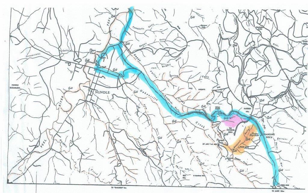
Map: Nundle up to hanging rock
blue is the road up to hanging rock
pink is good for looking for Crystals
Orange good for Metal Detecting

1385628259_map_nundle1.jpg
 
I can honestly say that the orange area is one of the most sh*itfully painful areas to detect ever :D Its steep, the ground is mega hot, hot rocks, clay domes etc. It has more trash than anyone can imagine. Coil at waist height still results in frequent overloading. The slopes have this tussock type grass that means you can get the coil on the ground. Honestly everyone should go there and detect just to remove the trash!

Cheers for the map though, it's one I haven't seen before
 
Good map, do you know what the base map is and is it available?

As Ben said the terrian marked for detecting is pretty difficult. One Nundle local told me detecting would never be successfull in the Nundle area because Metal Detectorists were all old and could not cope with the roughness of the country.
 
Im here now I think I could build a house with the nails I found . But most of them are bridge spikes lol. Did find a little pewter dish all bent up and a button better than the nails I found hahaha.

Dibs
 
Sometimes the trashy areas everyone walks away from can hide the best rewards for the patient minded. And the steepest ugliest hardest path is the least walked.
Sounds like a quote from the bible! Lmao :D
 
There is Hanging Rock, the cliff face and nearby Hanging Rock the village named after the former. There is a bit of surface gold (stress the word "bit") in the mauve area where crystals are found. Go to the crystal track (immediate 1st turn to right after entering track to Hanging Rock (not the village). The area to the south of the crystal track is worth a go, particularly down in the gully to the west. Also on the north side of the road there are a number of creeks and mines. Cemetery Rd, Verdon Road. Maps (as the one shown above) are available from the visitor centre within the caravan park. Watch out for leeches!
 

Latest posts

Top