Quick update everyone been busy getting everything setup for the app, my Apple Developer account expired two days after I posted about writing this app so I had to organise to renew that. :8
I have been reviewing the mapping tools to use. Its been a while since I last did a mapping app so I wanted to make sure I was up with the latest and greatest toolsets out there for this.
It comes down to a choice of two: Google Maps or Apple's MapKit
We could go with Google Maps which will give us topo maps by default and a lot of other functionality out of the box but it needs an internet connection to work. I suspect I could probably get it to work locally but it may be difficult. Further investigation is needed.
Or we could go with Apple's MapKit which allows you to load your own tile set and work offline. It also works if there is an internet connection.
There is also another open source copy of MapKit we could use under a different name but I cant see a benefit to its use over the real thing.
Google also places restrictions on the number of transactions you can do in a day and after that you have to pay a fee based on overall usage whereas Apple's is free to use.
I will have to check but I also think we may have to use the Google product under Android but will get back to you on that.
If we go with a tile set based approach we can load our own topo maps but we will need a tile server to provide these at least for the first download to the device. Its a fair bit more work on my side but thats ok, glutton for punishment

There may also be some other online resources for tile servers we could take advantage of.
It would mean you would have to download the maps for the area you are interested in before you go out on your trip. How do people feel about doing that?
I suspect people would want to load their own layers for an area they have researched which is why the tile based method is appealing.
So right now I am leaning more towards Apples MapKit product. Thoughts?
Here is the current set of requirements, anyone got anything else to add to the list?
Please speak up now as I will be closing the scope of the product off at that for the 1st Release at the end of this week? There will be other releases so its not your last chance to have a say in its development if you miss out this round.
Requirements:
- maps that show national park boundaries relative to your GPS location[/*]
- GPS enabled maps so you can navigate to or around crown land features and the boundaries of existing EL's and ML's[/*]
- GPS enabled mapping on mineralogical and radiometric maps[/*]
- EL and ML data optional to turn on and off that tells you the expiry , holders name and mineral types[/*]
- Lists of fossicking areas across Australia[/*]
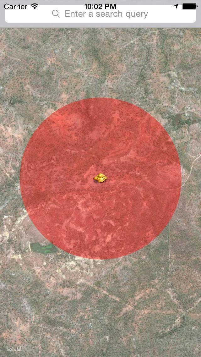
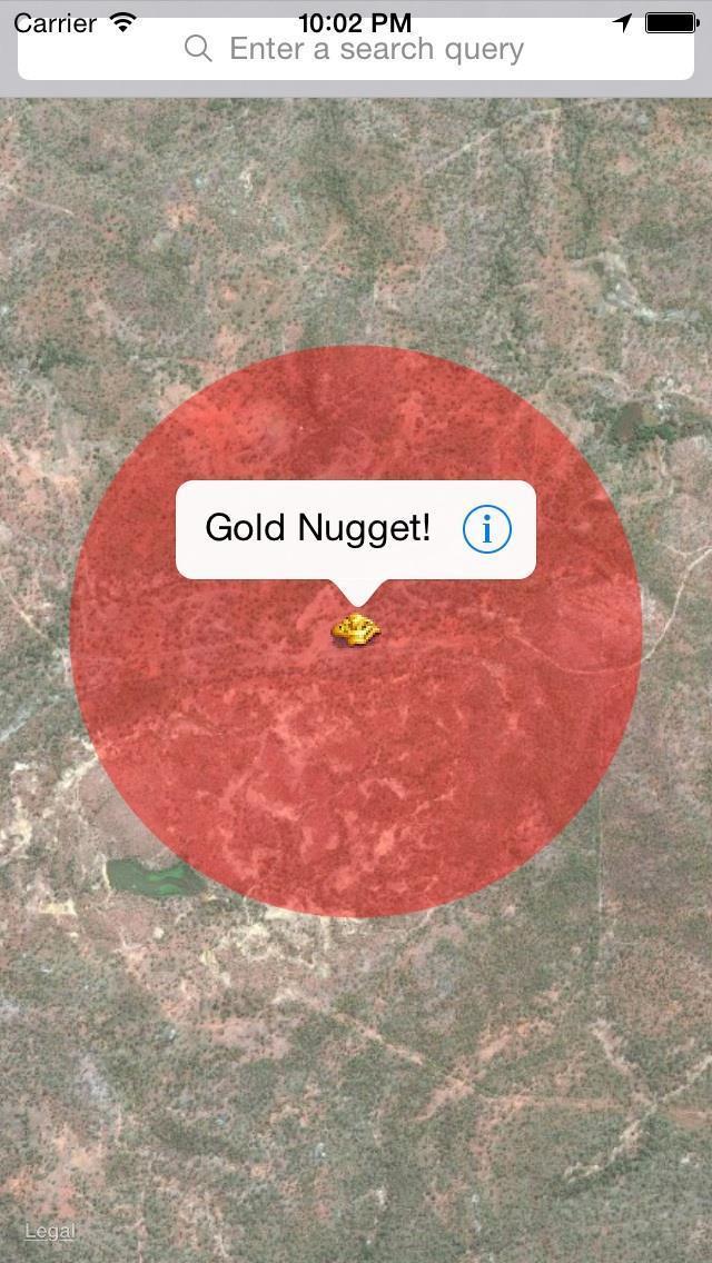
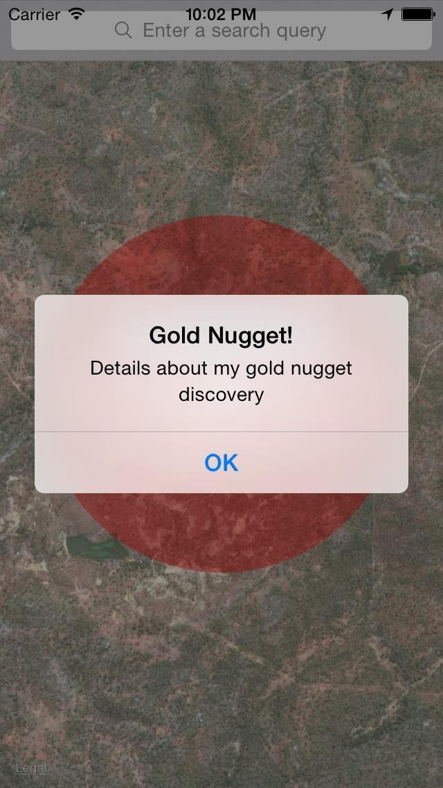
- A note pad style thing for putting info about your finds/where,pics,be able to pin the location on a map[/*]
- Instant messenger[/*]
- audio output mapping with gps coordinates, [1] so I don't walk over the same area twice [2] audio frequency mapping matrix to objects [3] review and be able to analyse data from the trip[4] sharing data optional with other prospectors to avoid trashed, overprospected areas.[/*]
- [5] GPS messenger , for emergency[/*]
- [6] alerts on old mines and shafts[/*]
- store the info locally on the device and then you could sync the data back to your PC at home to load it into your favourite mapping tool like Google Earth.[/*]
- layers mostly in vic geovic data I.e.e leads working detail etc. O e app I use allows me to import old maps and syc them with locatipns to give estimates of location.[/*]
- Adding waypoints with the ability to take a photo and link to the waypoint and snyc with cloud feature so o can show people where ive been and look at tgis on my pc as well.[/*]
- a GPS emergency locating signal would be handy [with a auto dialling signal][/*]
- a feature could be to detail what type of gold was found in each location eg: alluvial, reef, fine coarse or shotty etc. It might be a stretch but then people may be able to figure out if an area is worth doing their type of prospecting in, detecting or panning?[/*]
- Could you include UTM as well as Lat/Long, it's much easier to work in meters when transferring waypoints to and from paper maps and GPS, rather than juggling degrees minutes and seconds?[/*]
- an options setting so people can choose coordinate system i.e. UTM or Lat/Long, they want to use by default.[/*]
- a gps that does a decent job of logging.. finds, where you left the car, and how you get back.[/*]
- a gps that has topographic maps with hiking and fire trails updated, a normal road map, geological maps and a mineral resources maps would be good.[/*]
- a nugget finder (wishful thinking) [/*]
I am working on the base application at the moment. i.e. all the things that make it an app, menus, navigation, etc. so will provide a link to download once the basics are in place. Then we can start work on the actual features.
Cheers,
Grant