Thanks for all of the replies, I have heaps to learn 8) Here is some more information, sorry this may be a long post but I will start from the start.
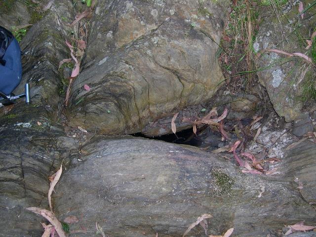
I first thought this area looked interesting because the rocks around the area had a rusty look to them, I first sampled this crevice and got a little gold from it.
https://www.prospectingaustralia.com/forum/img/member-images/1408/1402804237_crevice.jpg
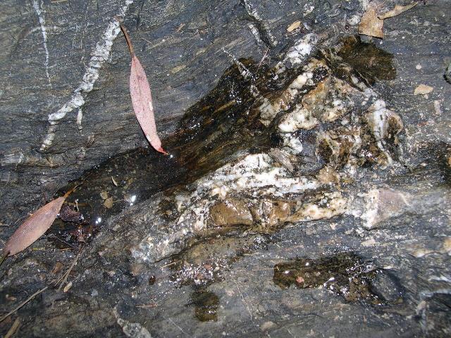
Interestingly I found the following intrusion between the bedrock.
https://www.prospectingaustralia.com/forum/img/member-images/1408/1402804302_creviceintrusion.jpg
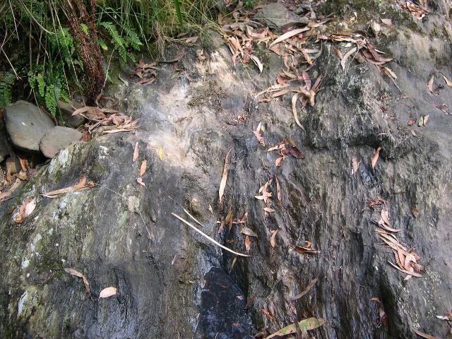
I moved up around 5 meters and found this vein, I have previously posted about it here.
https://www.prospectingaustralia.com/forum/viewtopic.php?id=4216
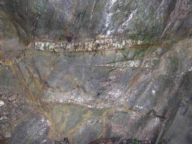
Vein 1
https://www.prospectingaustralia.com/forum/img/member-images/1408/1402804526_vein1.jpg
Host Rock, the white area is where I have recovered the quartz.
https://www.prospectingaustralia.com/forum/img/member-images/1408/1402804551_vein1hostrock.jpg
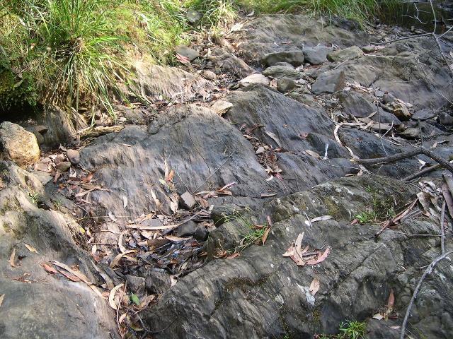
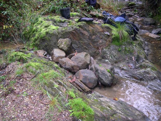
Vein 1's area
https://www.prospectingaustralia.com/forum/img/member-images/1408/1402804574_vein1area.jpg
To me these rocks look different to the normal slate, they are slightly smoother and harder to get the quartz out of! The vein is in the creekbed and this picture is looking upstream. There are a heap of different quartz veins, and some of them are associated with very green and red rocks, others are like the above pictures. To the right of the creek the hill goes up quite steeply and the foliation in the slate is almost vertical, it is also a grey colour.
Vein 2
https://www.prospectingaustralia.com/forum/img/member-images/1408/1402804922_vein2.jpg
Vein 2's area
https://www.prospectingaustralia.com/forum/img/member-images/1408/1402804982_vein2area.jpg
This area is not to far away from the first and the quarts is on the other side of the first slate outcrop, the distance between the area is around 30m as the crow flies and the altitude would only be a few meters different between the two sites. The direction of the slate has changed direction, in fact as you walk between the two locations the angles of the foliation change a lot.
The amount of gold recovered from this creek is not a lot, less that 1g for a year. But there was some mining activity for over a decade in the area and they never quite found the source of the gold. Vein 1 could be a lode with its chunky gold but I was hoping it would be bigger than a few centimeters across
")
So far I have just been testing with a mallet, cold chisel (not the band) and a dolly pot. Vein 1 had no fine gold in it, just chunks the biggest being a few millimeters long and vein 2 had some fine gold in it, certainly less than vein 1. The area is known for its faults and dyke hosted gold.
mbasko, I kind of understand but not quite. Unfortunately both veins are in the creek bed so I wont be digging too far down, I was hoping I could find an outcrop of the reef up the hillside that is quite steep.
Araluen, is there any particular way to do a sketch map of the geology?
Thanks againall for your help, I hope I have answered some of your questions.