Ancient river course

Prospecting Australia

Help Support Prospecting Australia:

This site may earn a commission from merchant affiliate links, including eBay, Amazon, and others.

Goldtarget

(AKA OldGT)
Joined
Jan 12, 2014
Messages
4,350
Reaction score
6,818
Location
, VIC
Just putting it out there for all the knowledgeable members, i need a little guidance. Spent an hour close to dark to dark sampling up a watercourse in a gold bearing area a gully if you want to call it that, between two rises that progress to hills as the gully widens and deepens. Now I've searched this area and there is no loaming, no workings, no diggings that I have been able to locate. I wouldn't go so far as to call it virgin ground but the old timers were too busy or unimpressed. Several hills and gullies over from this location are heavy workings of reef shedding, and puddling of shallow alluvial workings that have been reworked in the past, and present.

Now my sampling shows zero results up and downstream in this gully except in a 100m stretch where ironstone and quartz patches appear as gravel bars. But oddly the surrounding tertiary deposits on the surrounding topo are deep several feet deep in most places, but at this particular section running perpendicular to the flow is an extensive band of these gravels at the surface approx 2 metres in width but run uphill in both directions. Panning revealed fine gold in good quantities inside the current watercourse but i ran out of time to try the gravels above the watercourse.

So here's my question, is it possible that the current course has intersected an old watercourse, or can gravels like this appear in small pockets naturally occurring to look like one? And secondly without a nearby reef how else would this gold get here, or to be more precise can good really be pushed over a hillside with enough water force behind it? Obviously i need to spend some more time in recon to assess the situation but i wonder if anyone can add some input. I should note here my gut tells me its an old course, and not the first I've discovered in the area, but certainly its an odd location. Any input welcome.
 
Hey Goldtarget,

Be easier to discuss with photos.

Gold must be shedding off a reef somewhere in the surrounding hills.

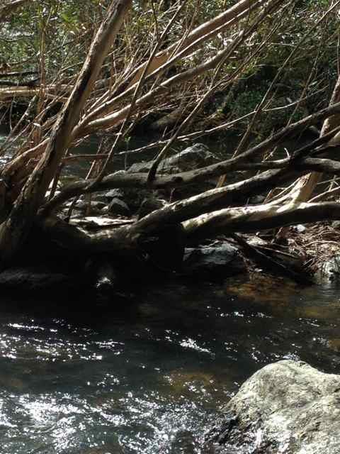
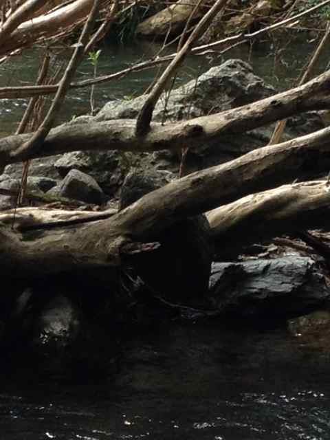
Don't ever doubt the power of water to move gold heres a few examples of the power of a creek in flood:

Decent sized boulder stuck up a tree:
1400933445_img_0619.jpg

1400933489_img_0618.jpg


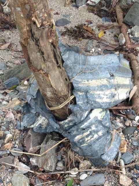
A piece of roadside guard rail bent around a tree like it was tinfoil, try bending that stuff yourself and it wont bend:
1400933707_guardrail.jpg


Gold will move like anything else in the creek even though its heavier than most other things.

Regards,

Grant
 
Goldtarget said:
Just putting it out there for all the knowledgeable members, i need a little guidance. Spent an hour close to dark to dark sampling up a watercourse in a gold bearing area a gully if you want to call it that, between two rises that progress to hills as the gully widens and deepens. Now I've searched this area and there is no loaming, no workings, no diggings that I have been able to locate. I wouldn't go so far as to call it virgin ground but the old timers were too busy or unimpressed. Several hills and gullies over from this location are heavy workings of reef shedding, and puddling of shallow alluvial workings that have been reworked in the past, and present.

Now my sampling shows zero results up and downstream in this gully except in a 100m stretch where ironstone and quartz patches appear as gravel bars. But oddly the surrounding tertiary deposits on the surrounding topo are deep several feet deep in most places, but at this particular section running perpendicular to the flow is an extensive band of these gravels at the surface approx 2 metres in width but run uphill in both directions. Panning revealed fine gold in good quantities inside the current watercourse but i ran out of time to try the gravels above the watercourse.

So here's my question, is it possible that the current course has intersected an old watercourse, or can gravels like this appear in small pockets naturally occurring to look like one? And secondly without a nearby reef how else would this gold get here, or to be more precise can good really be pushed over a hillside with enough water force behind it? Obviously i need to spend some more time in recon to assess the situation but i wonder if anyone can add some input. I should note here my gut tells me its an old course, and not the first I've discovered in the area, but certainly its an odd location. Any input welcome.

I like this mate....dig more test holes and thoroughly test pan the guts out of every layer at every level. im still doing this at my dig and its teaching me heaps and that the gold is primarily in a 200-300mm wash layer that I cant see very well but can feel it with my pick as I chip away and hit the stones in the (greyest)clay. my spot has taught me that it takes time and serious effort to get the answers and zero in on the target. I think the harder it is the higher the possibility of a good result. I hoipe you hammer this gully and it gives the reward. a jaggered footy size piece of really pink mineralised quartz came out of the wash yeaterday arvo....diiiiiiig! ;) :cool:
 
Hi Gold target,

I'm thinking that it might be a deep lead that has been weathered away and this gully has exposed it......
That's so cool to find something like this :cool:
Cheers
Uncle Bob
 
I took two positives, first there is gold. Second is not been worked. I will be back there later in the week with the auger and a few snaps on the camera to help those guide me, as stated not the first choose I've found but just in a really odd spot. Tbh i want shocked at three gold except its a long way from known deposits in unlikely typographical location. Watch this space
 
Goldtarget said:
I took two positives, first there is gold. Second is not been worked. I will be back there later in the week with the auger and a few snaps on the camera to help those guide me, as stated not the first choose I've found but just in a really odd spot. Tbh i want shocked at three gold except its a long way from known deposits in unlikely typographical location. Watch this space

the ground im working is not marked on geo survey or topo maps or even close to closest occurance area....gold is where your about to find it!
 
Haha that's a bit random. No white clays in this area, but definitely a good place to start in some of the places closer to home. Knocked over a few clay benches in recent times for some gold. More orange and brown, with ironstone and quartz wash, crushed a few samples of quartz veined host rocks for nothing special. I did take a couple of happy snaps (a practice to help with association when im leaving a place to return later, or to map in pics good sample points) but nothing worthy to give you an indication, i think it will be more confusing than clarifying, but i might put one up to evidence what I'm on about.

Just looked over my last post pretty poor editing.
 
1401019616_img_20140525_220334.jpg

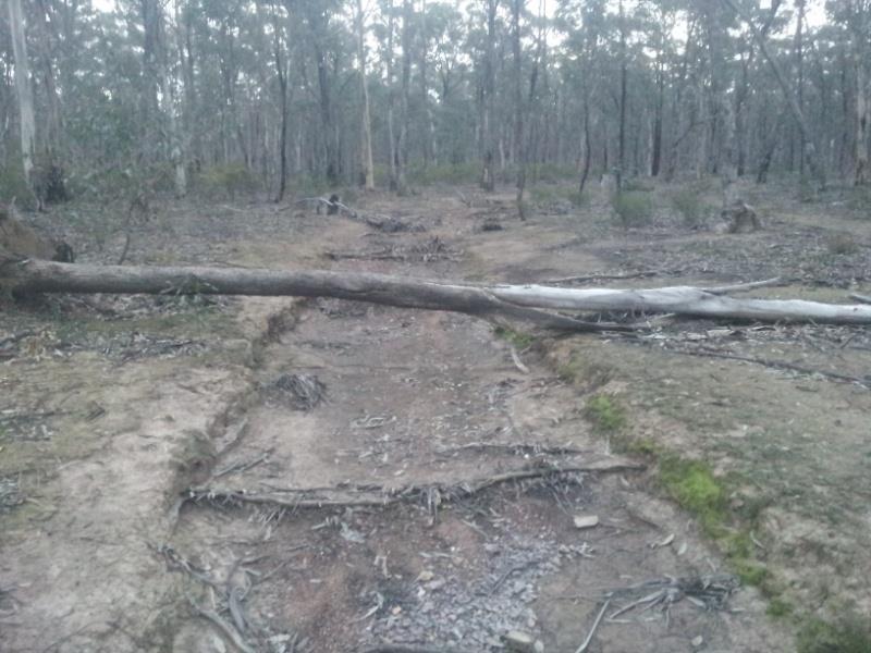
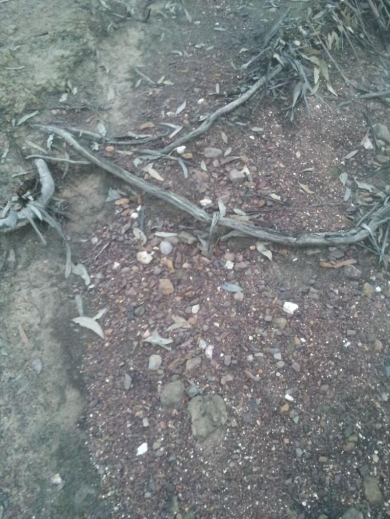
Gully at the mouth, looking W. Flow heading E. Reefs in area traditionally E/W orientation. embedded gravels run across the course SW/NE similarly to fallen tree.
1401019827_img_20140525_220217.jpg

Gravel beds inside gully in isolated stretch that match matrix of embedded gravels, from which fines were recovered.

Not great pics but best i have on hand.
 
Its hard to offer educated advice not knowing the exact situation that you face Goldtarget, however i have had some luck by always searching out shallow ground underlaid by bedrock. Because most drainage lines migrate to the left or right over even a few tens of thousands of years its always worth sampling off shallow bedrock near a gully (if there is some present). If there is any shallow bedrock near the gully on the inside of any bends (ala well known traditional sampling methods) i would try there, even if some distance from the gully. If the gravel spread down your gully is feeding in from one point on a slope somewhere it may be worth considering moving up slope at the point in the gully where the gravel is first seen.
I realise what i am saying is basic but i thought i would throw it in anyway.
good luck Goldtarget
Cheers RedDirtDigger
 
Thats some good reading goldtarget, now im racking my brains for the spot I last saw gravel similar to this.
Good luck with the creek bed there!
 
Goldtarget, I don't have any experience with your area or old diggings but to me the gully looks man made, could it be associated with the nearby diggings? It could explain why the gravel is in a few locations.
 
Quite possible. In fact probable. This shot is near the beginning linking several shallow watercourses into one, but deepens dramatically further downstream and becomes deep pools and the snaking observed in natural flows. Best course of action is to get some pics up relating exactly to the description I'm giving. The gravel in the pic is upstream of the ones I sampled with gold but more or less similar. The surrounding bushland has obviously been logged heavily in the past the stands of trees with a few exceptions are new growth forests, perhaps this was originally an access track. Many moons have past since timber was cut here on a commercial basis, so an unused track perhaps became a drainage channel. With any luck I'll have some time tomorrow thurs at the latest to photo map and from there delve into more recon.

I can assure you the nearest worked ground is quite some distance away, i trekked in almost 2kms to get to here from an old site. Any worked ground in the area is very obvious, i followed this in from the mouth tracking ballart or native cherry trees which follow the gravel course, that is a central point enclosed by an ironbark stand in an area dominated by grey and yellow box. All great indications but the proof is in the testing. The quartz is very isolated to a very narrow band, quite unusual, normally it appears in significant quantities, but the surrounding layers are all deep tertiary bands of dirt that hold very little visable gravels, and quite deep up to a metre in my estimation. Its a very different scene to that typically observed in the area, worthy of further investigation.
 
Goldtarget said:
Quite possible. In fact probable. This shot is near the beginning linking several shallow watercourses into one, but deepens dramatically further downstream and becomes deep pools and the snaking observed in natural flows. Best course of action is to get some pics up relating exactly to the description I'm giving. The gravel in the pic is upstream of the ones I sampled with gold but more or less similar. The surrounding bushland has obviously been logged heavily in the past the stands of trees with a few exceptions are new growth forests, perhaps this was originally an access track. Many moons have past since timber was cut here on a commercial basis, so an unused track perhaps became a drainage channel. With any luck I'll have some time tomorrow thurs at the latest to photo map and from there delve into more recon.

I can assure you the nearest worked ground is quite some distance away, i trekked in almost 2kms to get to here from an old site. Any worked ground in the area is very obvious, i followed this in from the mouth tracking ballart or native cherry trees which follow the gravel course, that is a central point enclosed by an ironbark stand in an area dominated by grey and yellow box. All great indications but the proof is in the testing. The quartz is very isolated to a very narrow band, quite unusual, normally it appears in significant quantities, but the surrounding layers are all deep tertiary bands of dirt that hold very little visable gravels, and quite deep up to a metre in my estimation. Its a very different scene to that typically observed in the area, worthy of further investigation.

round shot gun pallet sized magnetic stone is the indicator of gold concerntration in the wash of the clay ive been working, some quartz present but I think irealivant...more pallets more gold!
 
"...round shot gun pallet sized magnetic stone is the indicator of gold concerntration in the wash ...more pellets more gold!...."

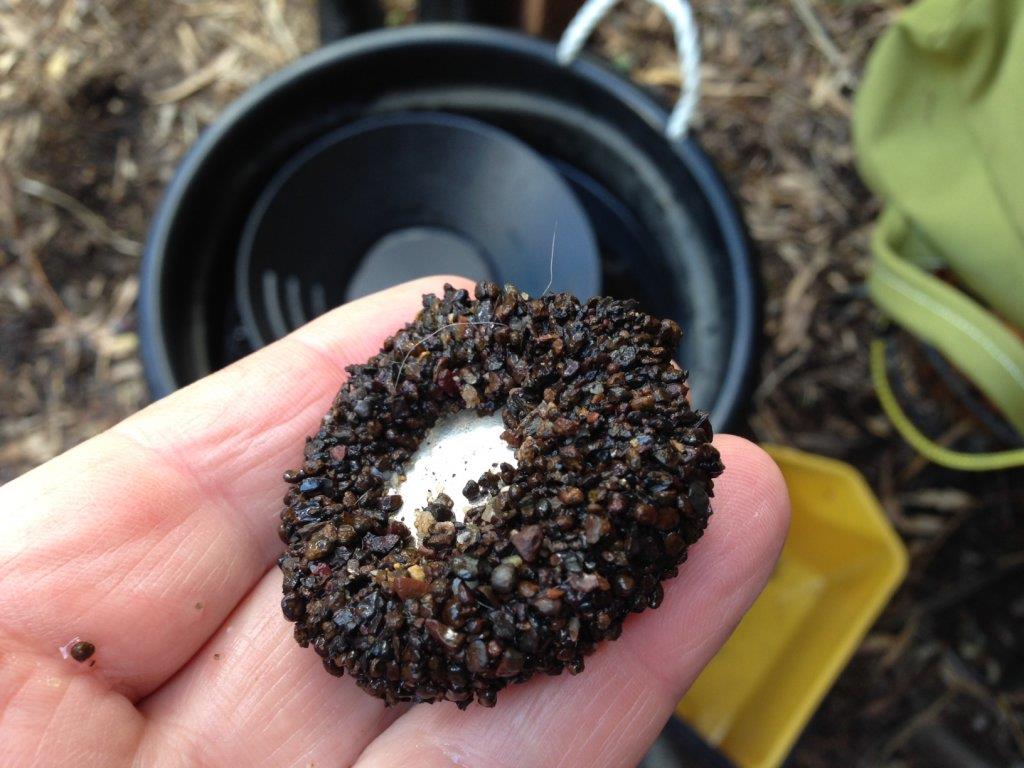
I agree and I have found the same - here's a pic of what i got out of 2 litres of wash dirt from a Yarra Ranges Creek - and yes there was gold in the pan.
1401142052_photo.jpg
 
Some of the old workings had water brought from a long way, could this be an old man made water channel?
I have been to old workings where channels have been cut for many klm. The chinese even built viaducts over gullies. The water was used for puddlers and in some areas for hydraulic mining. Tuena has evidence of this near the tip,
 
casper said:
"...round shot gun pallet sized magnetic stone is the indicator of gold concerntration in the wash ...more pellets more gold!...."

I agree and I have found the same - here's a pic of what i got out of 2 litres of wash dirt from a Yarra Ranges Creek - and yes there was gold in the pan.
https://www.prospectingaustralia.com/forum/img/member-images/562/1401142052_photo.jpg

'art of gold 9'...his words were "gold doesn't pick and choose rocks"...im thinking that discovering this magnetic shot relationship with gold still doesn't change that fact because I think it might have to do with the actual weight of the pallets being heavyest and dropping/holding in the same environment as gold does once its shed from its source and becomes alluvial.

this is what ive found how the gold behaves in the clay occurance ive been working but it may be an isolated situation. I have no comparison or knowledge of this in water as you have found (yet) but its good to know that someone else has realised this to and confirmed it a little more.

the more times a process is repeated the clearer the measurement of probability, I spent many many many hours in the last week panning every possible combination of ground in the clay and the results were conclusive that when I panned off the sands and other variouse stone in the wash and got down to only the black sand and pallets buried in it that good colour was allways present under that...

The pan doesn't lie!
 
a paragraph I read this arvo that I liked...

Geophysics uses a range of techniques to look for anomalous physical properties indicating
STRUCTURES or mineralisation not visible at the surface. The geophysical properties being
assessed include MAGNETISM, electrical conductivity, resistivity or capacitance; GRAVITY;
natural radioactivity or seismic properties.
 
Goldtarget said:
Just putting it out there for all the knowledgeable members, i need a little guidance. Spent an hour close to dark to dark sampling up a watercourse in a gold bearing area a gully if you want to call it that, between two rises that progress to hills as the gully widens and deepens. Now I've searched this area and there is no loaming, no workings, no diggings that I have been able to locate. I wouldn't go so far as to call it virgin ground but the old timers were too busy or unimpressed. Several hills and gullies over from this location are heavy workings of reef shedding, and puddling of shallow alluvial workings that have been reworked in the past, and present.

Now my sampling shows zero results up and downstream in this gully except in a 100m stretch where ironstone and quartz patches appear as gravel bars. But oddly the surrounding tertiary deposits on the surrounding topo are deep several feet deep in most places, but at this particular section running perpendicular to the flow is an extensive band of these gravels at the surface approx 2 metres in width but run uphill in both directions. Panning revealed fine gold in good quantities inside the current watercourse but i ran out of time to try the gravels above the watercourse.

So here's my question, is it possible that the current course has intersected an old watercourse, or can gravels like this appear in small pockets naturally occurring to look like one? And secondly without a nearby reef how else would this gold get here, or to be more precise can good really be pushed over a hillside with enough water force behind it? Obviously i need to spend some more time in recon to assess the situation but i wonder if anyone can add some input. I should note here my gut tells me its an old course, and not the first I've discovered in the area, but certainly its an odd location. Any input welcome.

Mate you asked the question is it possible that the current course has intersected an old watercourse, from the fine gold you have found in the area i would say yes on an old water course and or maybe a fine gold reef running through, so which one is it ? in this situation i would look for a reef line first thats gold bearing, 101 prospecting mate go to the highest point where you have found gold and start loaming for a reef line, that fisher detector you have just might be the right tool for the job, but slow coil movements would be the key as you are looking for fine gold built up in a single area to set the detector off.
Looking for the old river bed can be harder start at the lower point where you have found gold and dig the high points where the water has been flowing your looking for smooth rounded pebble if its an acient river course there will be smooth pebble, looking at the high spots is in case you stumble accross conglomerite, its harder than a cats head and can take thousands of years to break down, the new water course might be chewing away at the edge the acient river and depositing the fine gold in a very small area, by all means give me a buzz if you want some samples crushed to prove or disprove these theories.
goodluck ill catch up with you soon about the other prospects we discussed a couple of weeks ago.... :cool:
 

Latest posts

Top