THE NEWLY PROCLAIMED FOSSICKING AREA BARRINGTON TOPS

Prospecting Australia

Help Support Prospecting Australia:

This site may earn a commission from merchant affiliate links, including eBay, Amazon, and others.
Yes,
You can use a high Banker in NSW and State Forrest Fossicking Area's.
Check to see if native title has been extinguished in the area you wish to prospect.
The material must be collected by hand and then processed through the Banker.
Don't create excessive turbidity in the stream you are in. Ie; discharge the banker onto sand or use "Best Effort".
Fill your holes in after you have finished.
Basically, Use some common sense in what you are doing. If it doesn't feel right,,,
The rules were written with a fairly broad scope so simply, don't be a tool with what you are doing.
.
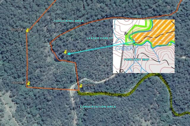
These are the basic's but check the Forestry website for more.
Above All, Have fun and enjoy it.
 
Guys I'm heading to Newcastle wed and desperately want to try my river sluice.all information looks negative but would appreciate a few areas on the new areas, Barrington, where fossicking is permitted.
Regards Phantom
 
Kawman,

Thank you for your help.

I think I will wait for warmer times and do some more research before I do a trip into the area.

I have seen a few spots on Google Earth, one is in the Rawdon Vale area. I would like to try and will need to contact the property owners first, but from my reading it appears many areas are not so keen to let fossickers into the area, apparently some historical bad experiences.

Regards,

Phantom
 
here is a list of fossicking areas that may help. :)http://www.forestrycorporation.com.au/visiting/activities/fossicking#maps
Phantom said:
Kawman,

Thank you for your help.

I think I will wait for warmer times and do some more research before I do a trip into the area.

I have seen a few spots on Google Earth, one is in the Rawdon Vale area. I would like to try and will need to contact the property owners first, but from my reading it appears many areas are not so keen to let fossickers into the area, apparently some historical bad experiences.

Regards,

Phantom
 
not all of the maps have areas that are known to have gems or gold.. use them to get to interesting areas you will find by doing some research.. :)
 
Been going over the forestry maps in fine detail and plotting the boundaries on google earth for uploading to my gps. and to my surprise if the maps are correct then Gummi Falls is not in a conservation area but a fossicking area by approximately 100 meters in the new area you guys are talking about. I tested the buildings on the map against google earth and they plotted exact - at least the gummi falls camping area is in the state forrest not the conservation area as claimed - I won't be paying to stay there.
1409979191_gummi_falls.jpg
 
Where you have the pin for Gummi Falls isn't that a No Fossicking Permitted area? That is what the orange stripes are supposed to mean.
 
I have wondered about that spot above gummi falls along the manning river and its edge myself. The orange lines denote state forest under exploration lease( el 8062), but from the river to the west seems to be a legit light green marked fossicking area. It seems currently an accounting firm is in charge/ owners of of el 8062. I might have to contact forestry and the exploration lease holder to get clarification on the map just to be sure, but the camp area looks like it is in state forest even if its covered by an el so no paying np for camping there.
We were up there again abit over a week ago but hit a different area, lovely country up there.
Rod
 
do they own the rights to all the orange striped areas on the map or only that one area?? :)
rod said:
I have wondered about that spot above gummi falls along the manning river and its edge myself. The orange lines denote state forest under exploration lease( el 8062), but from the river to the west seems to be a legit light green marked fossicking area. It seems currently an accounting firm is in charge/ owners of of el 8062. I might have to contact forestry and the exploration lease holder to get clarification on the map just to be sure, but the camp area looks like it is in state forest even if its covered by an el so no paying np for camping there.
We were up there again abit over a week ago but hit a different area, lovely country up there.
Rod
 
you sound like you have a good handle on things.. I await your findings... I would love to findout how to overlay the forestry map onto google earth.. The forest map uses meters for its c,ords and another map I have has degrees on it.. I cant work out how to convert from one to the other.. :/
rod said:
Hi kawman mate, exploration lease 8062 covers most of the striped state forest area up north, although there are some smaller el's up there aswell. You can search el's here
http://minview.minerals.nsw.gov.au/mv2web/mv2

I will recheck the owners and get back to you
Rod
 
Open the forrestry map in adobe reader go edit analysis geospatal tool gps co ordinates are then seen bottom r.h corner of screen write the positions down then transfer them to google earth convert to a gps track and waypoint and upload to gps as for gummi falls pin position when you transfer the co ordinates to the forrestry map it is in the green area according to the actual map of the conservation area it ends at the manning river below gummi falls however national parks obviously have a different idea . Been through all this nonsence before at the fisheries enquiry a few yrs back where they were lining up trees with clouds etc for their marks and fining people without proof and I have no doubt this is the same this is the reason I'm marking all the boundaries as I will know exactly where the fossicking boundaries are and if challenged I have proof. :D
 
how did you go mate.. Any progress on the google earth/forrestry map overlay... It would unlock a lot of known gem bearing areas that are marked on a special map I have.. 34 known gemstone bearing coordinates.....one day I will crack it... :)
rod said:
Heres the most current list i could find with el 8062 on it, Axis Consultants pty ltd is listed as owner from 2013 - 2015

http://www.resourcesandenergy.nsw.g...eports/MineralsMonthly-ELsCurrent-2014-08.pdf

The overlay you mention would be a gooden, will have to see if it can be done.
Rod
 
Hi kawman mate, i looked but couldnt find an existing overlay. Invaders technique would work for boundries of state forest, rivers ect, but would take along time to do the whole map. I have some print maps with exact locations i am going to try and scan, make transparent, resize and overlay on the state forest map, will let you know how it goes and if it works.

I didnt realise either that the stop mining group up there had it within their demands that ALL the state forest up there be converted to national parks, glad it didnt pass, but they still managed converted a bunch of spots to np in around 2006 and spell the end for cluff mine through constant legal harrassment, and unfourtunately most of the best gem bearing deposits now sit in the np, not all but most of the best.

I did however in my exploration find that geodes, amathyst and clear lined and calcite lined, exist futher south of dog trap creek road rhyolite outcrop, didnt find the eggs themselves yet , but found broken geode pieces with amathyst, calcite ect, meaning that upstream a rhyolite outcrop is eroding geodes that make it to the river and get smashed in their journey down it. My search up the river ended at the boundry of the glen nature reserve( the rhyolite outcrop was within the reserve and hence off limits) but i have yet to check further south where there is state forest.
Rod
 

Latest posts

Top