Bega Valley NSW information and questions

Prospecting Australia

Help Support Prospecting Australia:

This site may earn a commission from merchant affiliate links, including eBay, Amazon, and others.
Joined
Jun 12, 2021
Messages
12
Reaction score
7
Howdy all! Long time lurker, finally getting around to posting. Been traipsing through the bush washing dirt in a dish for a couple of years now, mostly up around the Bathurst area, but I've come home to Bemboka and have started having a poke around. Went up to Yambulla yesterday and had a marvellous time walking around, found a couple of specks but was mostly just enjoying the scenery.
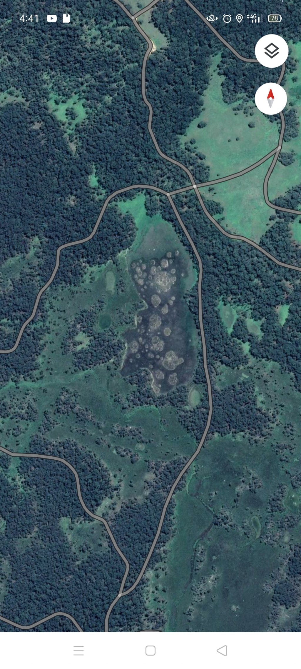
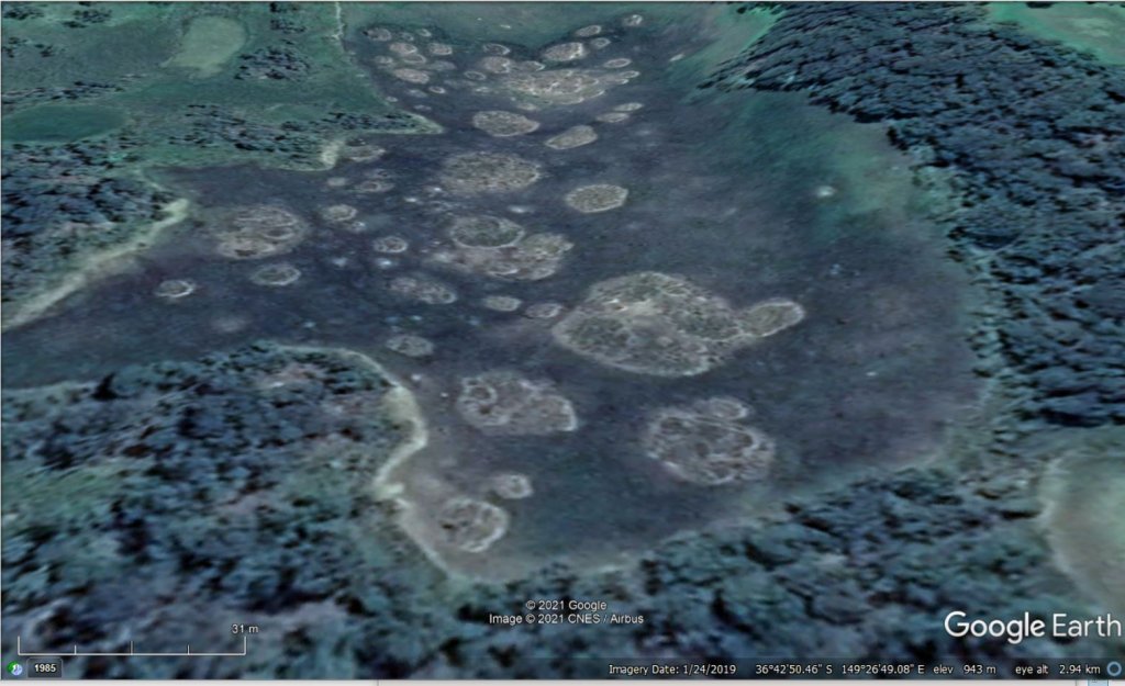
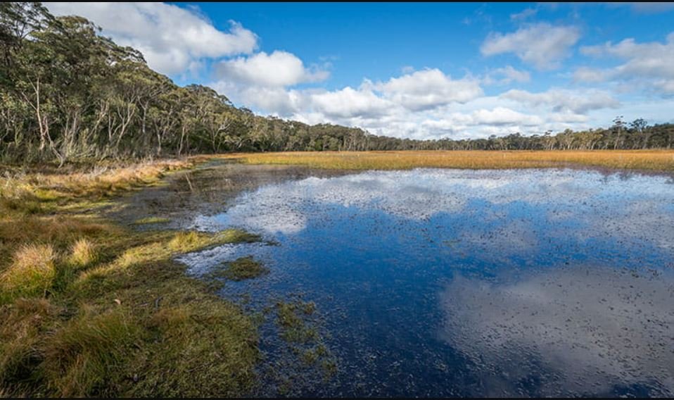
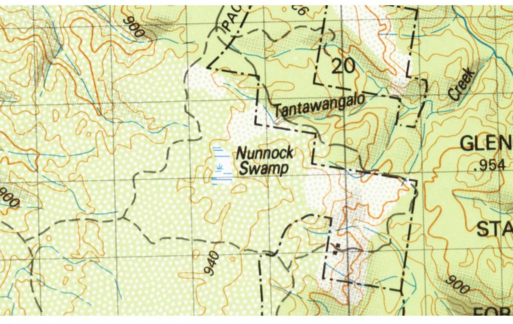
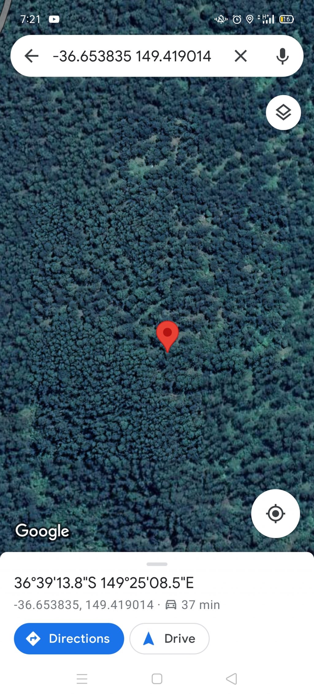
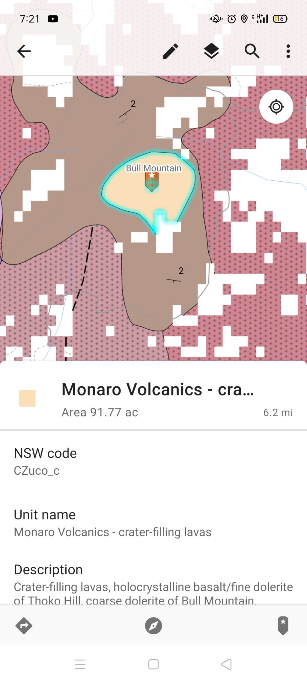
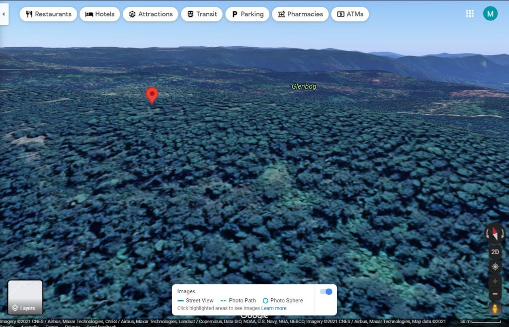
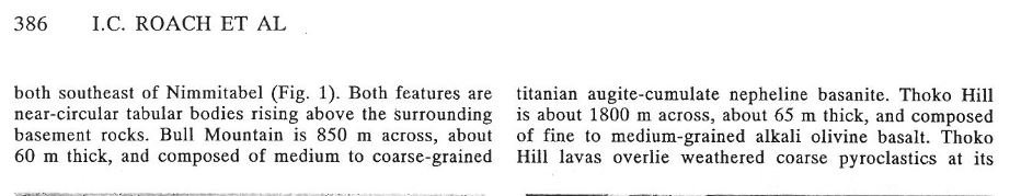
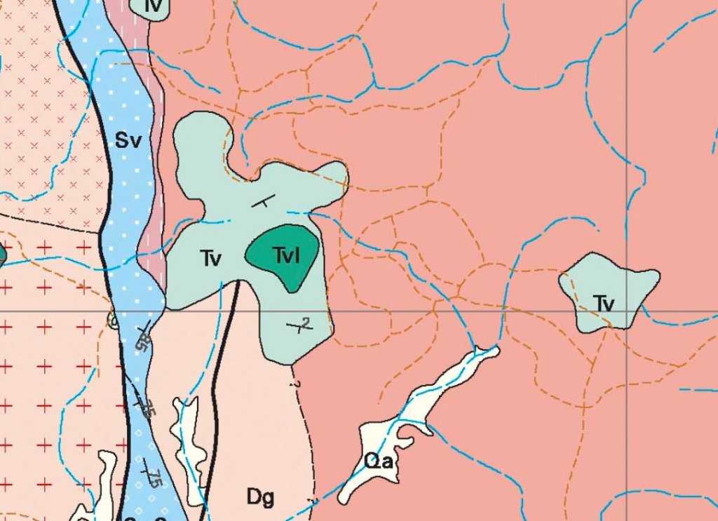
In the next few days I'm going to go up to the Glenbog and drive over towards Bull Mountain, not specifically for fossicking, mostly I want to check out some really cool looking geology including a feature that the geological map says is 'lava filled craters'. Just wondering if anyone has been up around there and knows any interesting places I should check out.
All the best,
Cam
 
1626420473_screenshot_2021-07-16-16-41-23-61.jpg

Here's the satellite image for the 'lava filled craters'
Looks super interesting
 
I would not have expected that to be the area on the geological map that referred to lava-filled craters - if you post an image from the map perhaps I could advise.

The only geological map I know in that area is the 250K sheet (and I seem to remember a 100K special sheet by Steve McQueen from Canberra that might cover it).

It is his 100K Bombala sheet, but unfortunately is not available from the Geol Survey website for download, so I can't check it.
 
You're quite right! Wrote the coordinates in my notebook in the wrong order. It's not too far away from the swamp though. I'll upload the screenshots. The map I'm looking at is the GSNSW bedrock map, the one from observations not the inferred seamless one.
 
I suspected that it might be Bull Mountain itself. I don't know what the two colours on your map represent. Bull Mountain is one of about 60 eruption centres of the Monaro Volcanics I suspect - haven;t been up it so cannot add much (don;t know of any specific papers on it).

Large blocks of rock exposed on the SW side.....
1626520852_mtside.jpg
 
goldierocks said:
I suspected that it might be Bull Mountain itself. I don't know what the two colours on your map represent. Bull Mountain is one of about 60 eruption centres of the Monaro Volcanics I suspect - haven;t been up it so cannot add much (don;t know of any specific papers on it).

Large blocks of rock exposed on the SW side.....https://www.prospectingaustralia.com/forum/img/member-images/4386/1626520852_mtside.jpg

This has a map showing the volcanic centres, including Bull Mountain

https://www.researchgate.net/public...New_South_Wales_Australia#fullTextFileContent

If you read into it, the Bull Mountain lava lake is mentioned in places

1626522150_bull_mt.jpg


Probably this report would have a detailed map, but I would not know where to get it (now university of Canberra)

1626523107_bull_mt_ref.jpg


1626524142_bull_mt_map.jpg


The full Bombala 100K map and the geological report can be found here. It is a central plug of dolerite surrounded by basalt flows.

https://www.researchgate.net/publication/272820966_The_Bombala_1100_000_geological_map

Have fun....
 
Fun I sure will have! Particularly in perusing your references. My idea of a good day out fossicking has far more to do with research, learning cool nerdy stuff and tromping through gorgeous bush than it does with actually finding anything valuable.
Thanks mate, you seem a wealth of information.
 
goldierocks said:
Large blocks of rock exposed on the SW
The full Bombala 100K map and the geological report can be found here. It is a central plug of dolerite surrounded by basalt flows.

Have fun....

Good ol' researchgate. Geology is a fairly recent interest for me, but as a physicist and philosophy, politics and whatever else buff, I do really love combing through papers with very little understanding and deciphering what's actually being said.
 
Alas poor Yorick said:
goldierocks said:
Large blocks of rock exposed on the SW
The full Bombala 100K map and the geological report can be found here. It is a central plug of dolerite surrounded by basalt flows.

Have fun....

Good ol' researchgate. Geology is a fairly recent interest for me, but as a physicist and philosophy, politics and whatever else buff, I do really love combing through papers with very little understanding and deciphering what's actually being said.
That is how you learn, and what can be more fun than learning out in the bush (why most geologists become geologists). The main thing you will probably see there is the coarse rock of the central volcano, and the surrounding finer-grained lava.
 
You could go and visit The Big Hole and Marble Arch , they are south of Braidwood . There is a camping ground there . The Big Hole is only a short walk . Marble Arch is a few k's .

Going more south , there is Snowball Goldfields . I have been there a few times .
 

Latest posts

Top