Am not able to answer the original Q re Google Maps, but
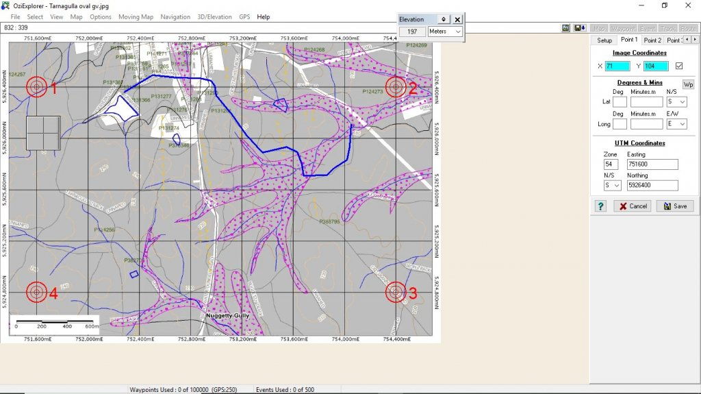
Map Calibration in Oziexplorer
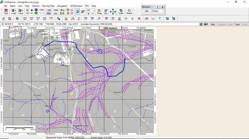
The Calibrated Map and a Track laid in
It can be a tedious process, here's what I've done;
1. Go to Geovic, set up the detail you want and save the file as a .PDF to your PC.
2. Open the PDF and do a PRT SC, this stores a screenshot to the Windows Clipboard.
3. I use Photostudio as It was a freeby with my scanner to create a new image from the clipboard and then trim it to show just the map and save as a .JPG.
4. Open the image in Oziexplorer by activating
Calibrate a Map Image and using the Grid Coords of the map, calibrate the Map and save.
5. This produces a .MAP file that will open in Oziexplorer.
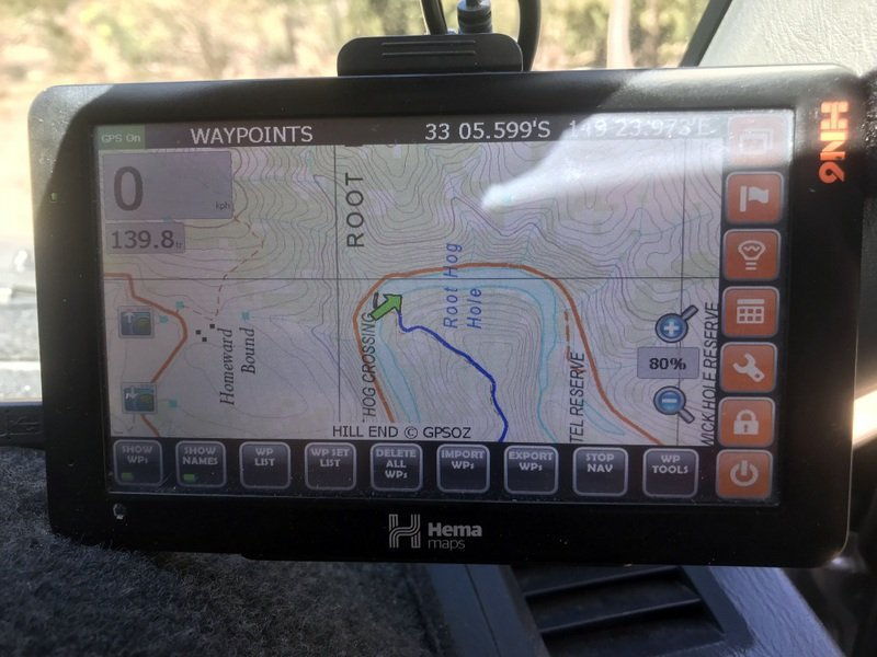
6. You then need to convert the map image to .OZF4 file format using the Ozi convert tool IMG2OZF which is freely available on the Ozi Web site. This then can be used in your Hema GPS
7. As i have done this for a number of areas in the GT, I then stitched all of the GEOVIC maps to one Map using Mapmerge (also an Ozi App)
I have the Hema HN7 GPS, it's Off Road mapping App is based on Oziexplorer and will open the map file. You can then transfer Tracks and Waypoints to and from your PC to Hema or save track trails when out there. The Hema comes with an Oziexplorer App for your PC, however it is a Lite version that allows Tracks and Waypoint creation, but to my knowledge will NOT allow you to make and calibrate maps. You need to purchase the full version of Ozi to do that.
Can seem complex, but once you get your head around Ozi it's easy, but in saying that I've been using Ozi for 20 years, including when working (DOD)
")