- Joined
- Sep 11, 2014
- Messages
- 1,484
- Reaction score
- 3,554
Hi guys,
A mate and myself set out on a trip last Saturday to suss out a very remote location we'd read about and have waited 3 years for the right time to try and get there, access was tough and not conventional which made it even more appealing to check out.
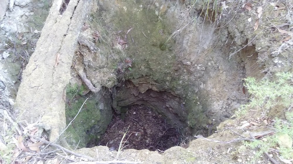
We had to battle our way in to the location and found what we had hoped to find, the old timers workings.
Locating the old dyke was a challenge and still not sure if we did, pretty sure we found the quartz lode located at the top of the workings.
The more we scratched around in the thick scrub the more the scene revealed to us, we had taken detectors in to do some searching but for the most part it was just too thick to detect, there was an area off to the side where some larger deep holes were dug so we managed a detect around them and started uncovering some relics before the day was getting on and we had to make the long trek out.
Question 1,
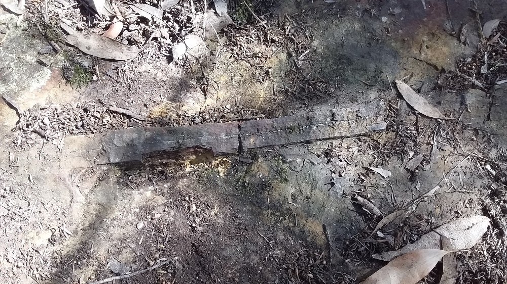
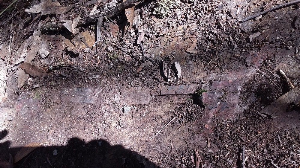
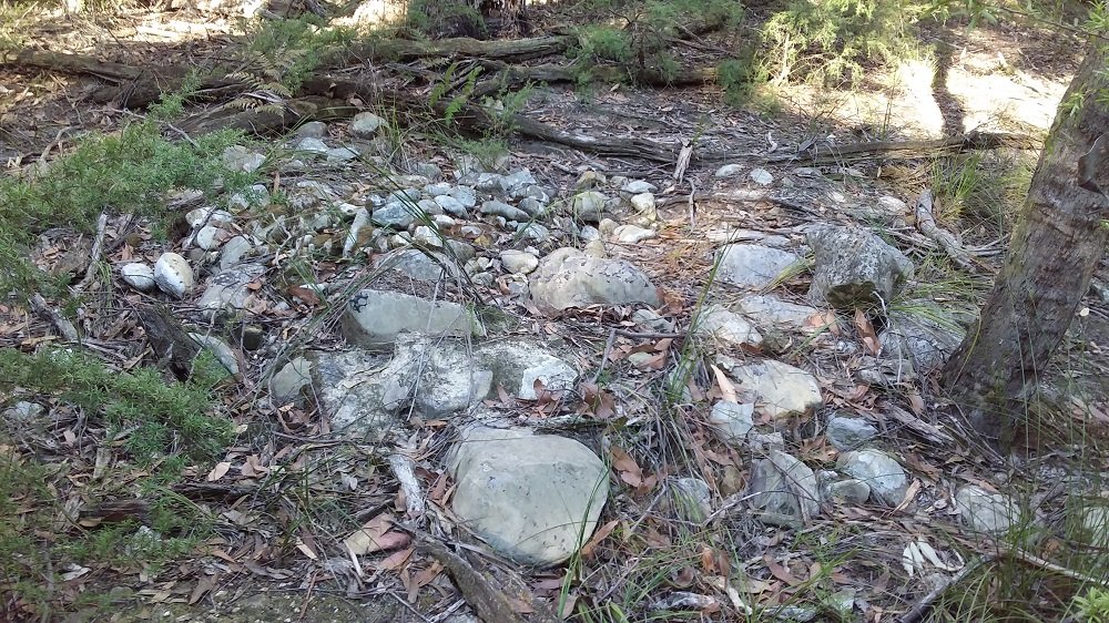
While trying to locate the dyke and in the general area of where it should be we found bedrock near the top of the hill running across the hill for 30 meters, this was the only exposed bedrock we found made up of sandstone(?) and a band of red rock with a fine quartz vein running through the centre, this line ran right across the exposed bedrock from one side to the other.
Is it a good indicator for a contact zone? This would have been about 50 - 100 meters to the side of where the quartz lode was located and the workings start at the top end of that gully. The gully was really rich in the day with big + ounce nuggets.
Question 2,
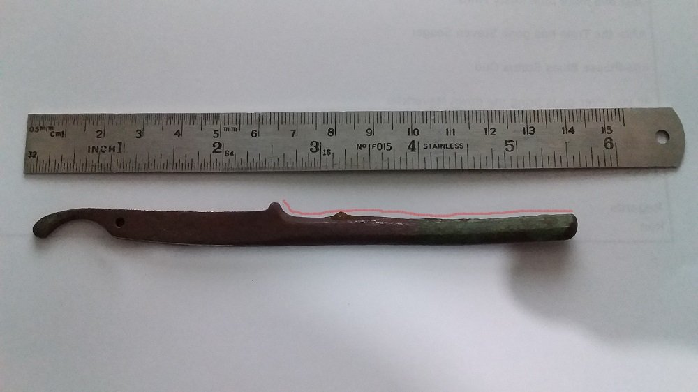
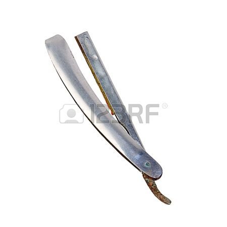
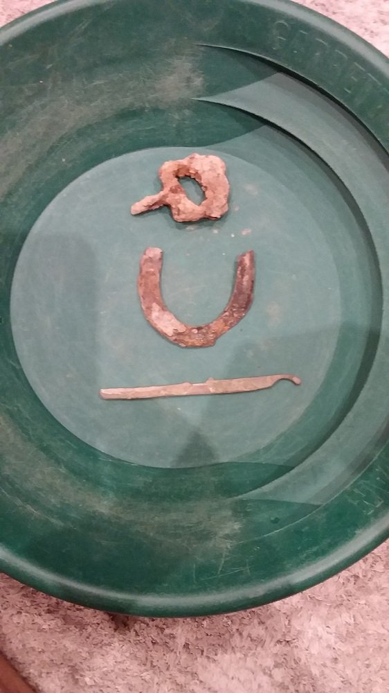
Can anyone identify what the long thing is in the pan, these 3 items were found along with other rust junk and a miners button in a 10m radius section between the deep holes and rock tailing pile.
Top item looks to be an iron buckle off a belt or horse saddle?
Middle item is a horse shoe but it is small and thin and would fit the heal of a boot, did they use them on boots back then? or would they have used small pony's?
Bottom item is the size of an arm from a pair of sun glasses but it's heavy and a green tinge to it so thinking it's brass or copper based but no idea of what it is.
Any suggestions what to soak or treat the copper/brass item with to help identify?
A mate and myself set out on a trip last Saturday to suss out a very remote location we'd read about and have waited 3 years for the right time to try and get there, access was tough and not conventional which made it even more appealing to check out.
We had to battle our way in to the location and found what we had hoped to find, the old timers workings.
Locating the old dyke was a challenge and still not sure if we did, pretty sure we found the quartz lode located at the top of the workings.
The more we scratched around in the thick scrub the more the scene revealed to us, we had taken detectors in to do some searching but for the most part it was just too thick to detect, there was an area off to the side where some larger deep holes were dug so we managed a detect around them and started uncovering some relics before the day was getting on and we had to make the long trek out.
Question 1,
While trying to locate the dyke and in the general area of where it should be we found bedrock near the top of the hill running across the hill for 30 meters, this was the only exposed bedrock we found made up of sandstone(?) and a band of red rock with a fine quartz vein running through the centre, this line ran right across the exposed bedrock from one side to the other.
Is it a good indicator for a contact zone? This would have been about 50 - 100 meters to the side of where the quartz lode was located and the workings start at the top end of that gully. The gully was really rich in the day with big + ounce nuggets.
Question 2,
Can anyone identify what the long thing is in the pan, these 3 items were found along with other rust junk and a miners button in a 10m radius section between the deep holes and rock tailing pile.
Top item looks to be an iron buckle off a belt or horse saddle?
Middle item is a horse shoe but it is small and thin and would fit the heal of a boot, did they use them on boots back then? or would they have used small pony's?
Bottom item is the size of an arm from a pair of sun glasses but it's heavy and a green tinge to it so thinking it's brass or copper based but no idea of what it is.
Any suggestions what to soak or treat the copper/brass item with to help identify?

")