What To Look For On The Goldfields (New To Prospecting)

Prospecting Australia

Help Support Prospecting Australia:

This site may earn a commission from merchant affiliate links, including eBay, Amazon, and others.
What a fascinating read Loamer, this is just the info I have been looking for.

My current spot has these test holes all over the shop and you can tell where they hit a bonanza by the hole in the ground being as big as a house. I think I might hit these holes and see what I can find. I read that they stopped mining in the area in the 1860 -70's due to a bad drought and all the water dried up...makes you wonder what they left behind??

Cheers,
Matt
 
hi loamer the pic you have of the reef workings, is that by any chance over west around norseman? if not, very similar country especially that pic looks very similar to a reef line on the old coach road from norseman to dundas
 
loamer your post re new ground is interesting, whilst over the west workin for 12 mths I virtually haunted around norseman and I have some great pics to show when I get my 10 posts up of quartz outcrops ranging from buck white quartz to burnt black brittle stuff on the same outcrop,in a creek running into lake dundas
 
jedda said:
hi loamer the pic you have of the reef workings, is that by any chance over west around norseman? if not, very similar country especially that pic looks very similar to a reef line on the old coach road from norseman to dundas

No Jedda - its in the Vic central goldfields region.
 
Thanks Loamer for the great information. We have not been detecting yet but we love reading the forum. Everyone has such great information and all seem happy to share and help each. Just waiting for our van and then we will be heading off. Donna :)
 
I heard the word "sandwich quartz"....I recently found an outcrop on the side of a road leading down to a creek and it was thin layers of quartz and rock, then quartz then rock etc. The creek had some nice coarse gold but no fine gold. Maybe ive found a good spot?

Peter
 
Awesome information on how our old Gold fields worked and some likely indicators, Thank you. Simply awesome.

Sorry one question. Did they used Hydraulic or ground sluice to surface it? or where they from small claims and hand dug?

have a great day
Phillip
 
All three Phillip, depending on location,and availability of water. 90% of surfacing by the first wave of prospectors (mid to late 1800s) was hand surfaced. They needed to be mobile and took the easy pickings before "Rushing" between newly opened gold fields.

The second wave of prospectors (late 1800's to early 1900's), where water was available, spent longer on the claims bringing with them high pressure pumps and bucket dredges to surface large areas of alluvial wash. Long water races to form high level dams for these purposes became very common.

The third generation of prospectors....( Jack and Tod Hoffman & co), preferred to use D9 Dozers for the same purposes.. :D :D ,

Cheers Wal. :)
 
Philski said:
Did they used Hydraulic or ground sluice to surface it? or where they from small claims and hand dug?

All done by hand, then the 'paydirt' was screened and transported to the puddler for processing.

Ron
 
This has been a great read and very good pictures as well. I enjoyed reading these posts thanks..Roscoe
 
Things to look out for - with pics and notes. (This relates to the Central Vic fields)

The weather has turned a bit coolish and tomorrow (monday 28th/10) is forecast for rain here in the Central Goldfields of Vic. So -thought I would have an admin day and upload some pics to highlight things that are worth keeping a look-out for. These pics compliment some of my previous posts.

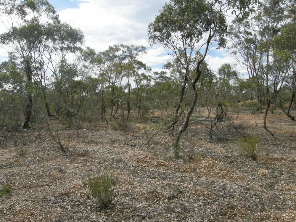
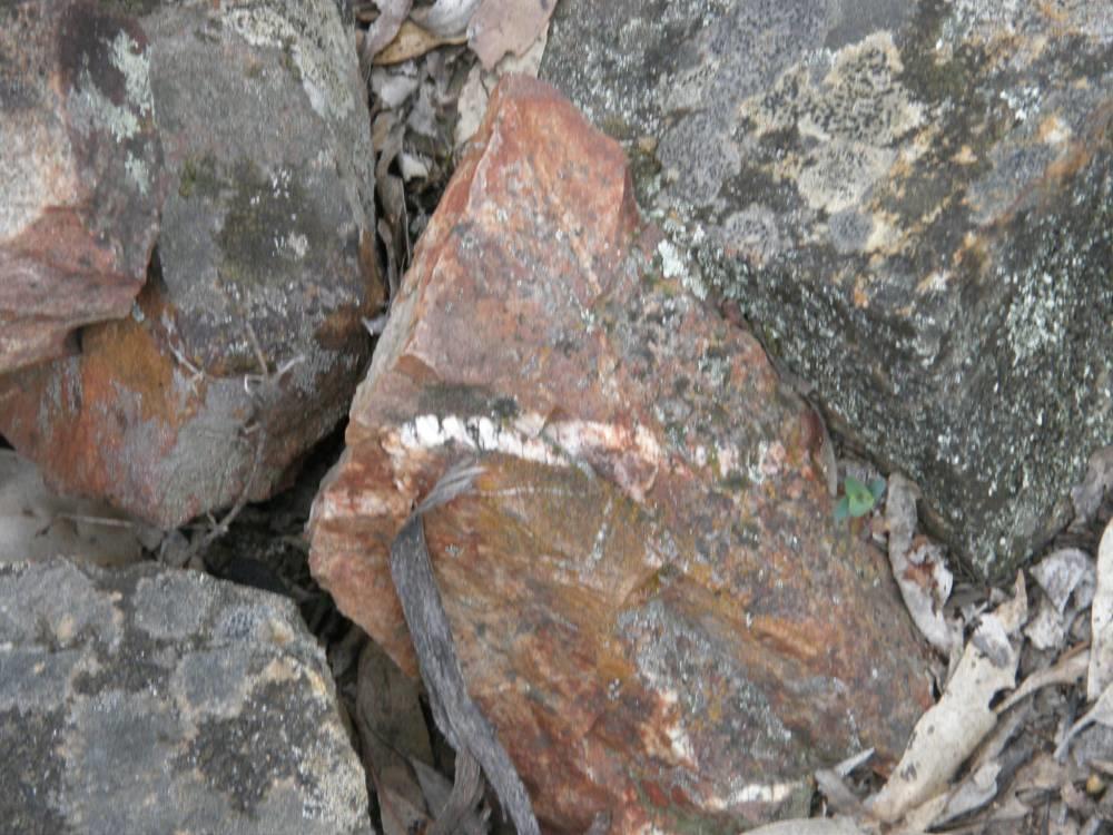
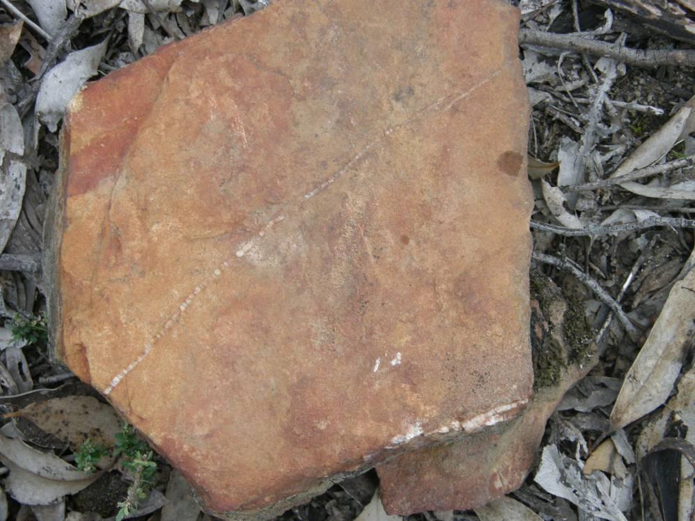
Sandstone Hills. In the majority of cases, reef gold (a primary deposit) usually only occurs in sandstone hills. A geological map will show you that Creswick, Castlemain, Dayelsford, Dunolly etc are located in this belt. To the north of Dunollly are granite hills, granite intrusions are also your friend. This relates back to the ancient deep oceans at around the time of the ancient continent of Gondwana. There is a geological story here in itself but suffice to say, with time, pressure, tectonic movement and the like, these sandstone hills were formed - the gold was a result of high temperatures, water, steam, chemicals and pressure and chemical changes. We are looking at rock that is sandstone with quartz associated with it. Quartz associated with sandstone is a GOOD sign. The layers can be very thin and you hear and read 'sandwich quartz, pencil quartz' and the like. This is, in this case, referring to a layer of quartz between layers of a host rock, in this case sandstone.

1382844239_quartz_in_sandstone.jpg


1382844471_pencil_quartz.jpg


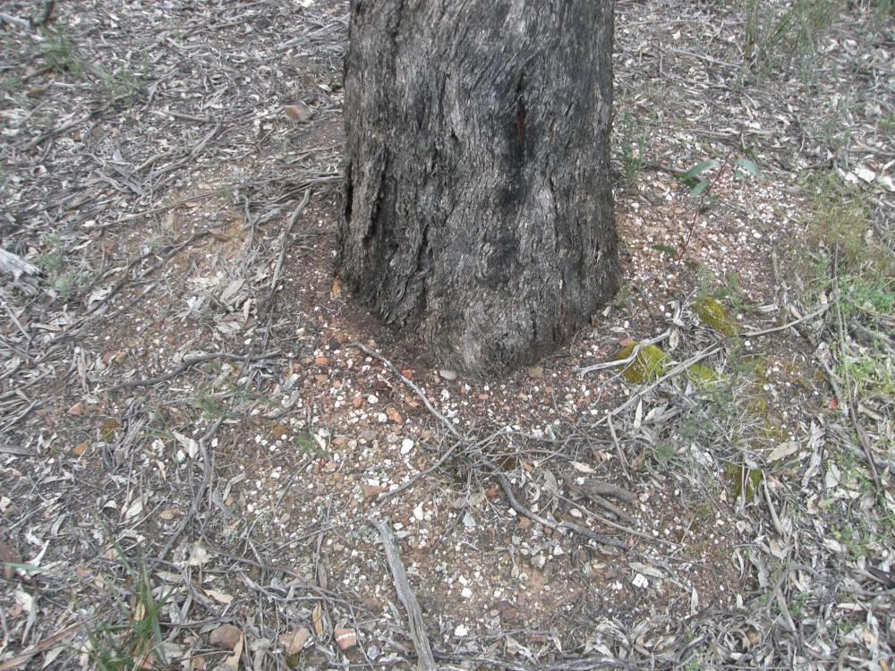
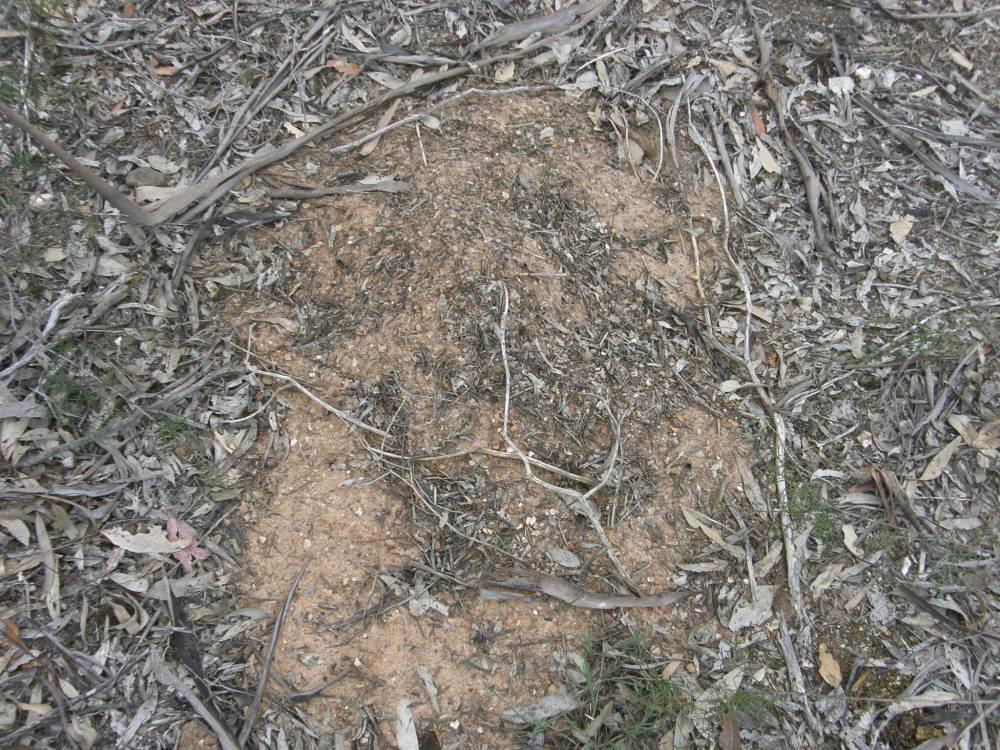
Depth of ground. Prospectors generally develop and eye for how deep the ground is, but what are we saying by depth? We are generally referring to the depth where gold is detectable, where is has come to rest in its travels. It could be as far down as sitting on bedrock, it could be sitting in or on the layers of wash, it could be sitting on a layer of hard red clay. An example of big gold above the bedrock is the Viscount Canterbury nugget was found in gravel, four feet about the bedrock. What are the signs of what type of ground you are on? There are some indicators as you are walking along to check. What is around the trees? What have they brought up? What have the ants brought up in their nests? What does the ground look like and what is on it.

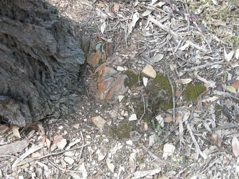
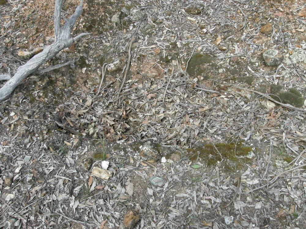
In this case, the box ironbark has dragged up and/or fractured a layer of sandstone. There are also some smaller quartz fragments scattered around the tree. This firstly tells you that you are in sandstone/quartz country and that the ground is probably shallow enough for gold to be detectable (in this case it most certainly was).

1382845140_aasansdtone_around_tree.jpg


In this case, the quartz and sandstone has been broken down quite a lot and you can see little bits of quartz in sandstone about. Again, the ground is probably shallow enough to detect.

1382845390_aaasand.jpg


What have the ants brought up? (here is a tip - a lot of tools throw lead bullets and other non-ferrous junk on ant heaps to give off a target signal. I have NEVER found a single piece of gold on an ants nest so I don't bother. All that happens is that the bullants get very angry and the parks and wildlife folk get annoyed as well. Leave them alone is my advice). However, Mr Bullant does tell you something - the ground is soft enough for them to dig in a nest and they have brought up small rocks, possibly from a layer of wash.

1382846750_aaants.jpg


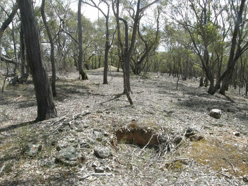
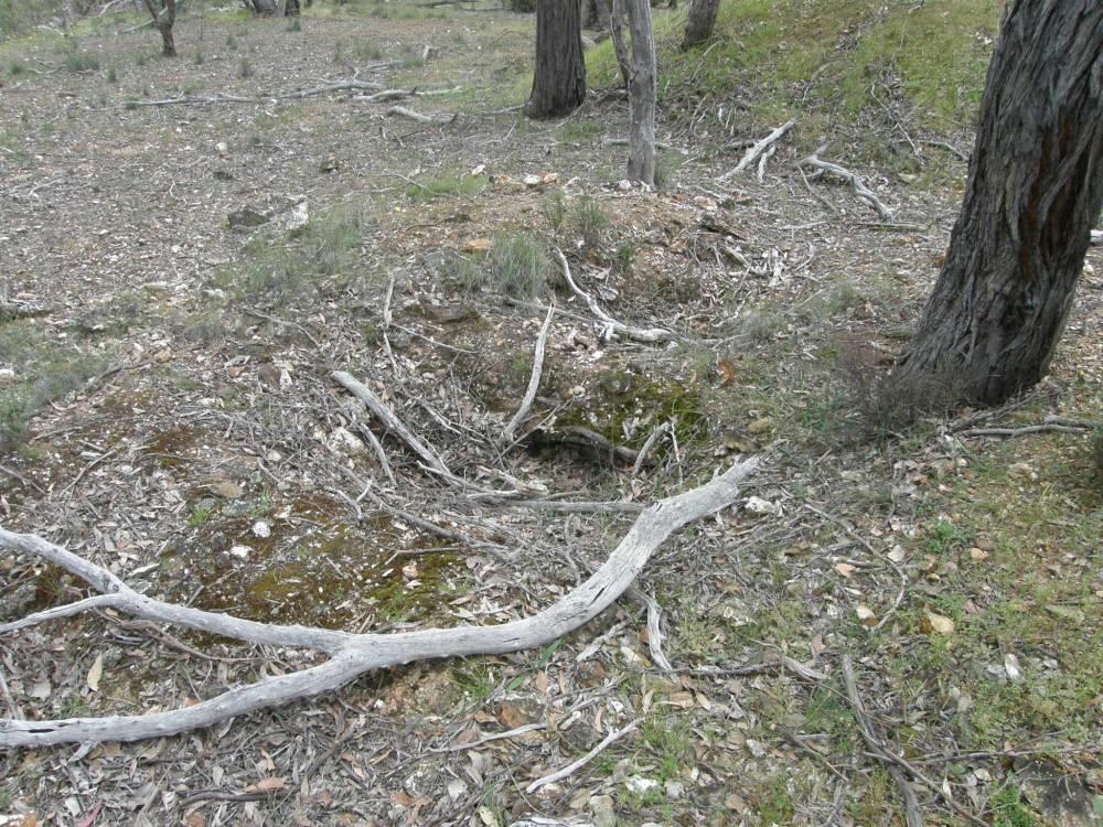
Diggers test holes. There are several references on some posts talking about diggers test holes. What are they? They were the old diggers following up what was to them suspect ground. Here are some examples. The first one is where they have simply taken out a shovel load of soil for checking (loaming) - the area this was taken had many of these types of markings. The second shows a dig hole on a hill top where they have tried to follow a surface reef - this hole led to a costean trench (pic in earlier posts) where they tried to cut, at right angles, the suspected run of gold in quartz. The third shows two holes side by side - I was doubtful of these holes and thought they must have been old rotted out tree stumps, but the hole at the back had a beaut little clean nugget in the spoil. These diggers test holes are generally not alone and may take a pattern of being in a straight line running to/from a set of diggings and/or reef digging.

1382847599_atest.jpg


1382847638_aaaatest.jpg


1382847789_a1test.jpg


Hope these few notes help. Remember - the ground beneath your feet is NOT level and can change in depth and type very quickly. As an example, if you are ever near the burnt creek lead as it runs north to Moliagul, the western side of the road is gold country = drive into the bush on the eastern side and you can actually watch the soil and trees change in a blink of an eye. Good luck.
 
wow, thank you for all this info! especially the photos! it's got me really excited to get back out there with all this new knowledge!
 
Pushed Ground - what does it mean.

When going around the bush on the goldfields - you will see numerous places that look like this. You may also hear and read the term 'pushed'. What does it mean? It means that usually a very rich area has been bulldozed to expose the original lead/wash/bedrock etc and the overburden taken, usually close by and treated. The spoil is then redeposited and planted as a form of rehabilitation. You will notice the spoil usually goes back like a line of furrows so that plants can take, water is trapped etc and everything looks nice and neat. What are your chances? If you are patient, quite good as there will usually be throw outs of smaller gold BUT it is very much hit and miss and there will be rubbish that will have you digging some holes. The added bonus is that gridding is simple - follow the furrows and hey presto, gridding solved. With these places remember, the original site would have been rich (Nuggety Gully near Tarnagulla is an example) to warrant the expense and time. Time and patience you should be rewarded.

1382918929_aaaapushed.jpg
 

Latest posts

Top